Nicholas Hedges

Art, Writing and Research

  • Facebook
  • Instagram
  • Pinterest
  • Twitter
  • YouTube
  • Home
  • Artwork
    • Selected Works
    • Galleries
      • Installations
        • Murder
        • The Woods, Breathing
        • The Woods, Breathing (Texts)
      • Photographs
        • The Trees
        • Shotover
        • Pillars of Snow
        • Places
        • Textures
        • Walk to work
        • Creatures
      • Photographic Installations
        • St. Giles Fair 1908
        • Cornmarket 1907
        • Headington Hill 1903
        • Queen Street 1897
        • Snow (details)
        • The Wall
      • Stitched Work
        • ‘Missded’ Tokens
        • ‘Missded’ 1 – Tokens
        • ‘Missded’ 2 – Tokens
        • ‘Missded’ 3 – Tokens
      • Miscellaneous
        • Remembered Visit to Birkenau
        • Somewhere Between Writing and Trees
        • Tracks
        • Portfolio
        • Posters for Exhibitions
        • T (Crosses)
        • Backdrops
        • Correspondence (details)
    • Continuing Themes
      • Missded
      • Lists
      • Heavy Water Sleep
      • The Trees
      • The Gentleman’s Servant
      • Fragment
      • Notebook
  • Blog
  • Exhibitions
    • The Space Beyond Us
    • Kaleidoscope
    • A Line Drawn in Water
    • A Line Drawn in Water (Blog)
    • Mine the Mountain 3
    • Mine the Mountain 2
    • The Woods, Breathing
    • Snow
    • Echo
    • Murder
    • The Tourist
    • Dreamcatcher
    • Mine the Mountain
    • M8
    • Umbilical Light
    • The Gate
    • Creatures
    • Residue
    • A visit to Auschwitz
  • Video
    • Look, trees exist
    • Look, trees exist (WWI postcard)
    • Videos from ‘A Line Drawn in Water’
  • Family History
  • About Me
  • Subscribe to Nicholas Hedges
  • Eliot Press

Proposing Moments of Pastoral

June 17, 2015 by Nicholas Hedges

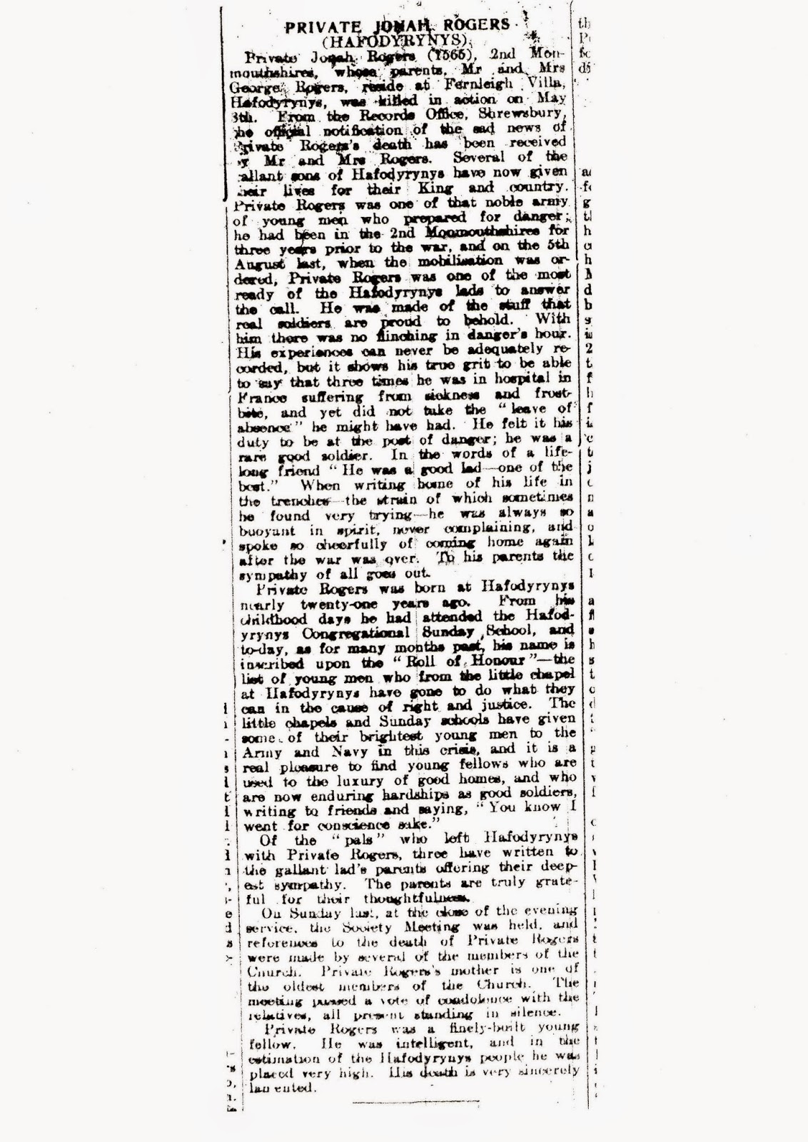
Through my research on World War I, I’ve accumulated a large amount of data – postcards, quotes, maps, texts, photographs, personal thoughts and experiences – which I want to start distilling into a new body of work. To do that, I’ve been looking for a ‘lens’ through which I might look again at this archive and thus begin shaping my research into something I can use in a work.

Quotes

A lens could be anything; an image, an experience, a thought, or in this case a quote – or quotes. I’ve discussed them before, but here they are again, the first from Neil Hanson, the second, Paul Fussell:

“As the torrents of machine-gun bullets ripped through the grassy slopes up which the British troops were advancing, the smell of an English summer – fresh cut grass – filled the air. For thousands it would be the last scent they would ever smell.”

“…if the opposite of war is peace, the opposite of experiencing moments of war is proposing moments of pastoral.”

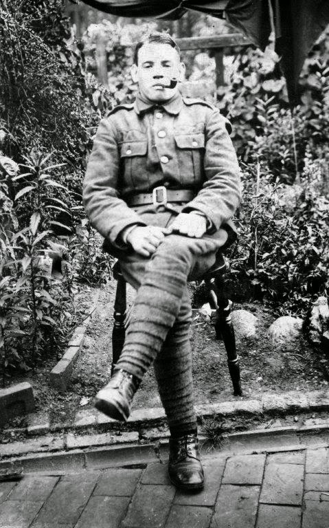
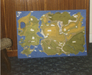
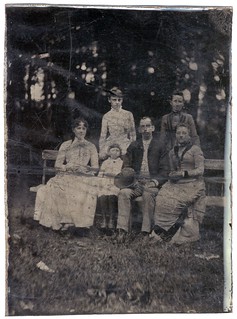
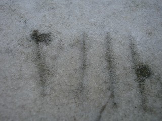
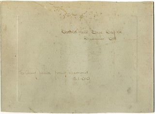
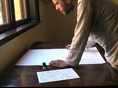
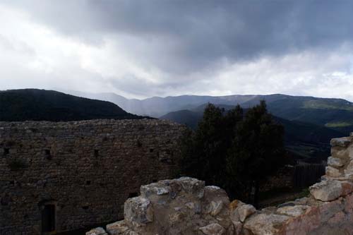
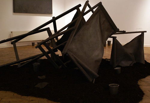
The smell of an English summer – fresh cut grass – and the idea of moments of pastoral come together to make a lens through which I can re-examine my research. I’ve used Neil Hanson’s quote before, as the title of a piece in 2007 (pictured below), but combined with Paul Fussell’s quote it becomes even more interesting.

The Smell of an English Summer 1916 (Fresh Cut Grass)

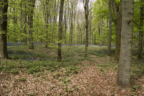
The smell of fresh cut grass is a smell I often associate with the past, in particular, my childhood, and as a child, my notion of the past was a pastoral one. To me, the past was an unspoilt place, where squirrels could run the length of the country without touching the ground (a ‘fact’ I always loved). I loved the idea – and I still do – of untouched swathes of forest.

The past was always pastoral.

Maps

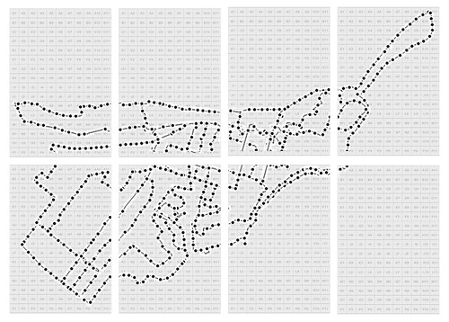
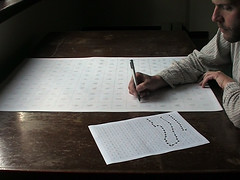
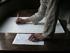
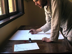
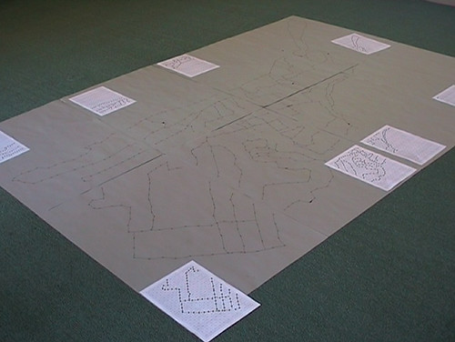
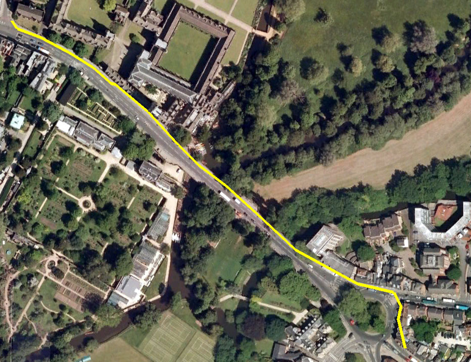
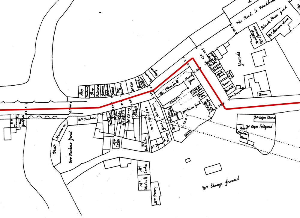
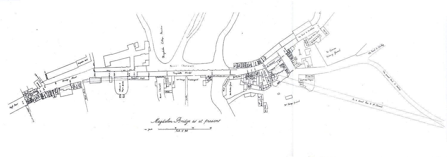
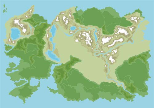
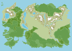
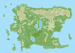
To pursue my pastoral fantasy, I would create maps of imagined landscapes (something I’ve also discussed numerous times before) and this too has become a lens through which to look at my research. When we think of those who fought in World War I, we often consider only their deaths. We don’t imagine their lives beforehand, especially the fact that not so long before the war, many were still children.

My maps were well-wooded.

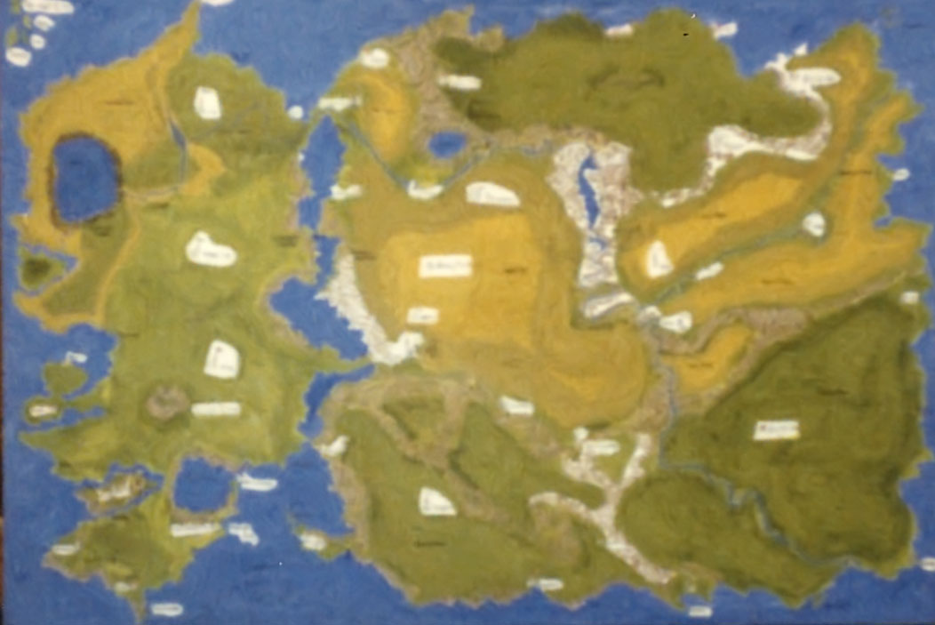
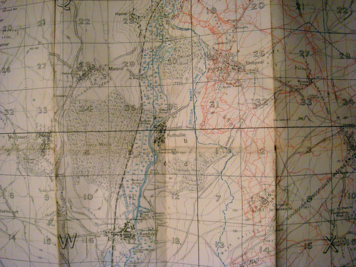
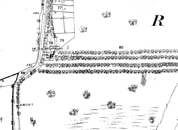
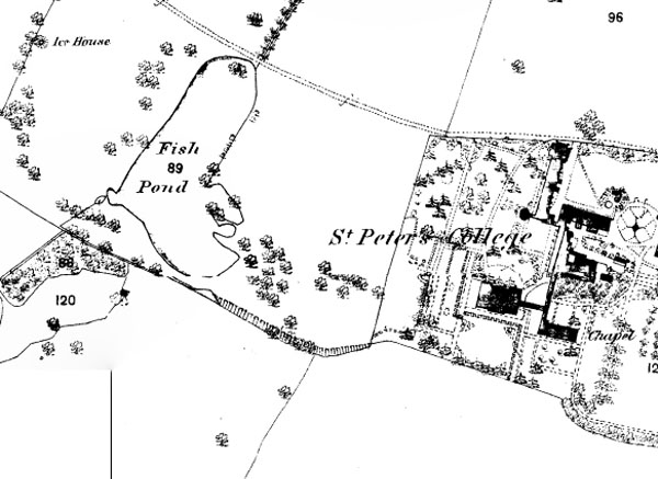
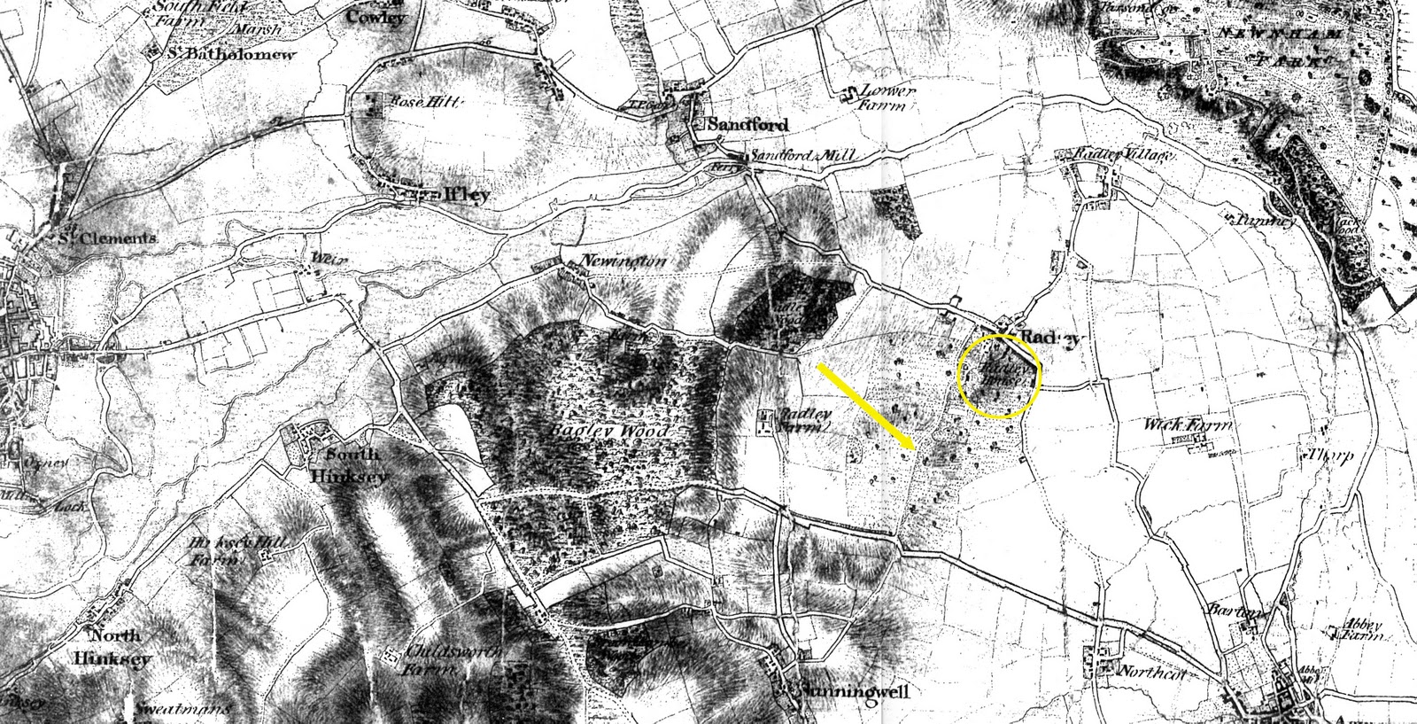
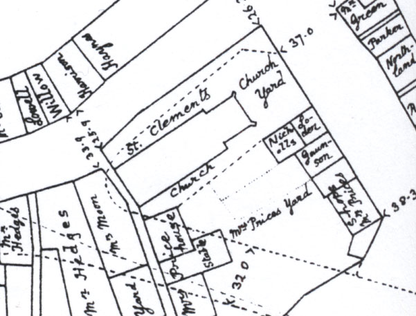
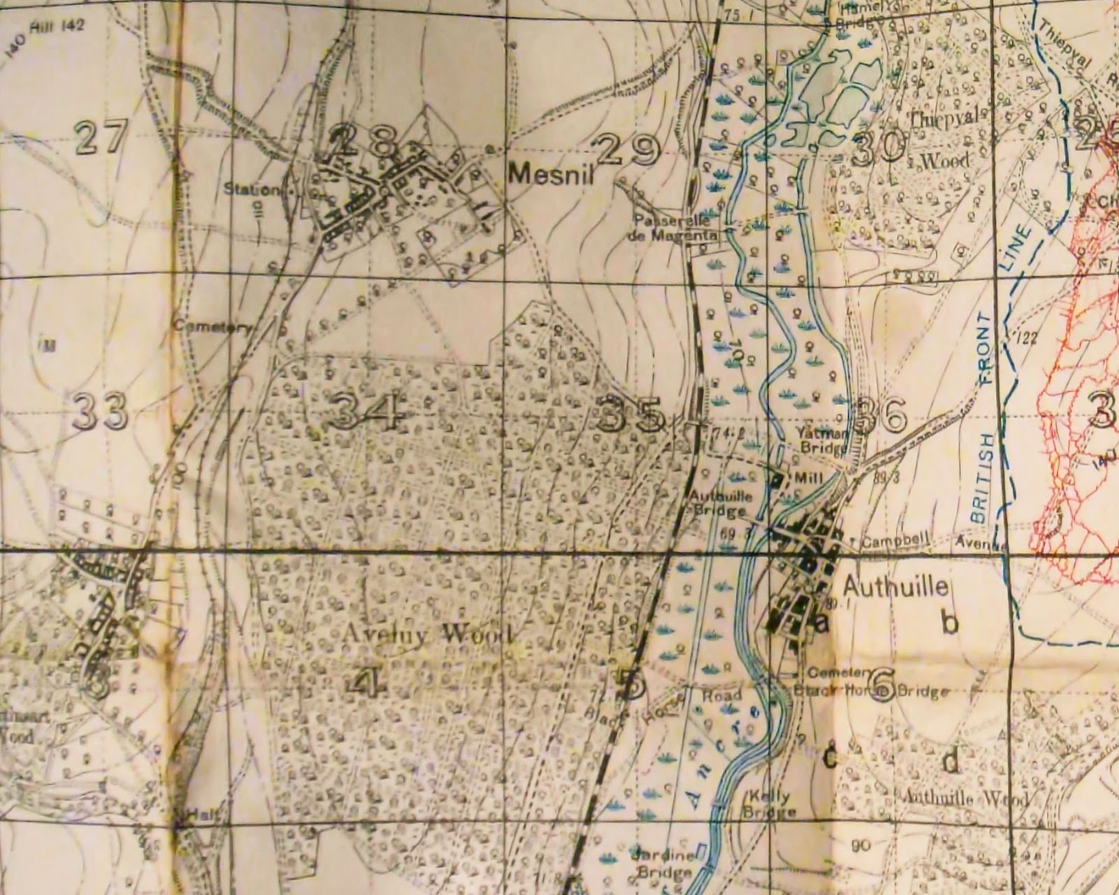
As are the trench maps I have in my collection.

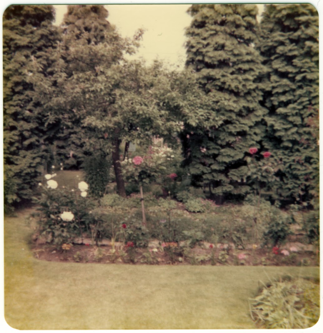
Postcards and gardens

There is a link therefore between a pastoral past, my childhood and the consideration of those who died in World War I as children years before – as real people who existed beyond the theatre of war.

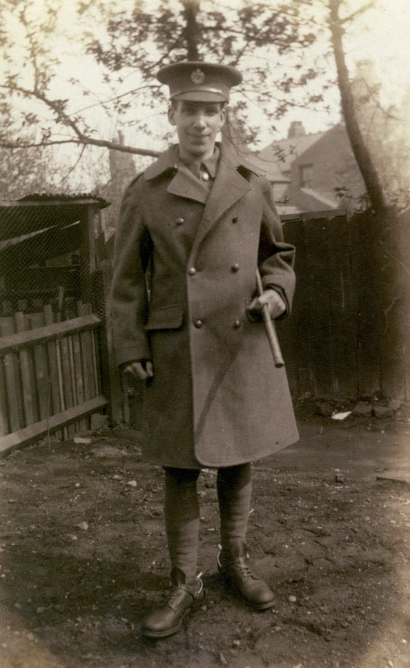
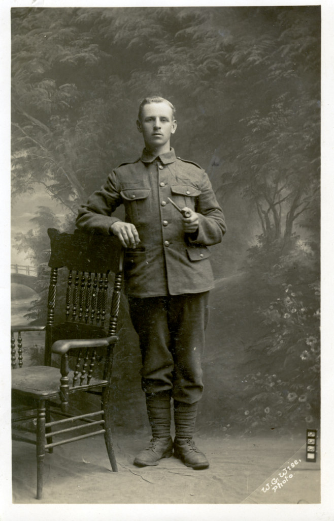
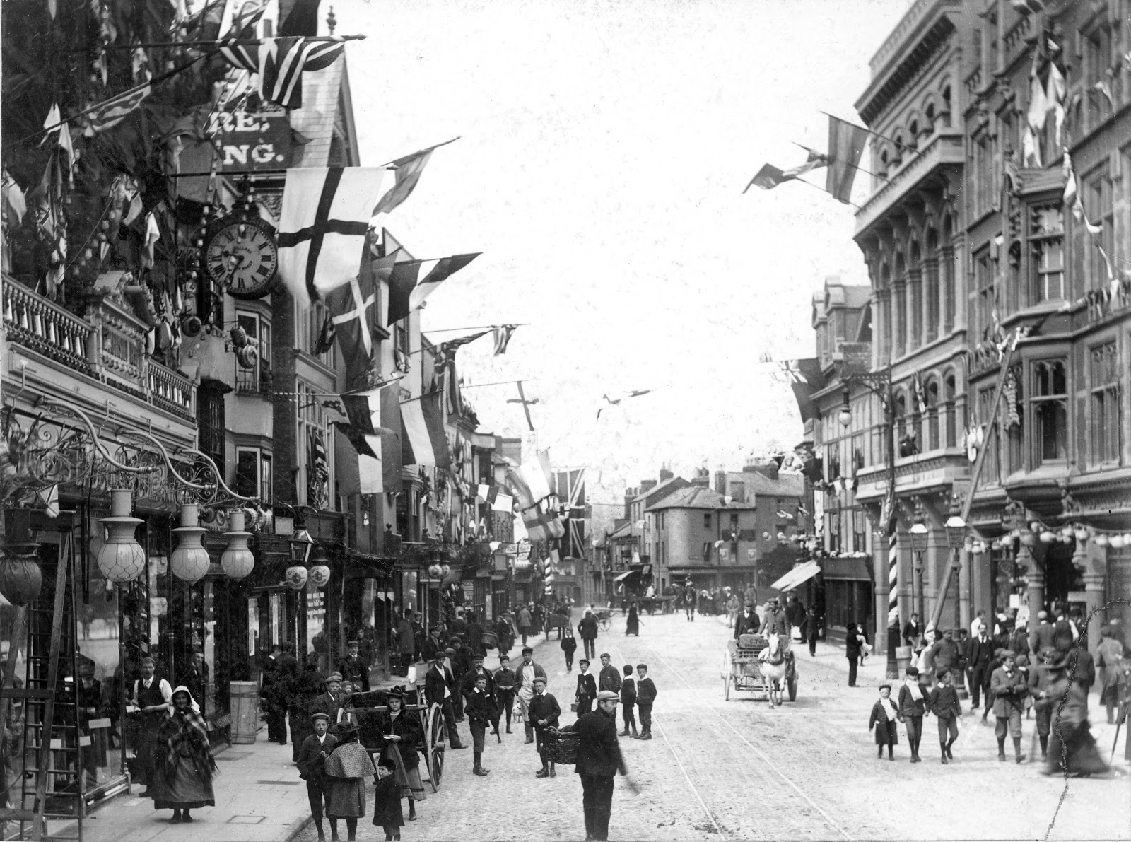
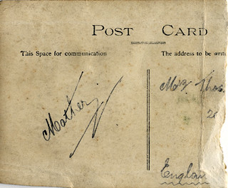
This leads me to postcards, such as the one below:

World War 1 Serviceman

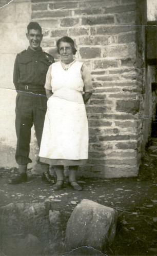
This postcard shows a soldier posing with his mother(?) standing in what might have been his garden, in the place where, perhaps, he grew up as a child. I might not be able to empathise with him as a soldier directly, but I can well imagine his garden. Part of the landscape of my childhood comprises the gardens of my home and those of my grandparents, as well as parks and playing fields at school. They are pastoral landscapes in miniature, where the grass was cut on a summer’s day.

Proposing moments of pastoral

The question which I haven’t asked is: how do you propose moments of pastoral? The answer to this, I think, is crucial to the development of any work.

To propose is to suggest, invite. It is something given to another.

Maps are objects which propose. But what are they proposing? On the one hand, they propose journeys. More often than not, we use them to plan a journey in the future, for example a day trip or holiday. They require us to use our imaginations; to imagine the future, the landscape and our position within in. They can however propose journeys into the past. In a previous blog about Ivor Gurney, I wrote:

After returning from the war, Ivor Gurney, like so many others suffered a breakdown (he’d suffered his first in 1913) and a passage in Macfarlane’s book, which describes the visits to Gurney – within the Dartford asylum – by Helen Thomas, the widow of Edward Thomas is particularly moving. Helen took with her one of her husband’s Ordnance survey maps of Gloucestershire:

“She recalled afterwards that Gurney, on being shown the map, took it at once from her, and spread it out on his bed, in his hot little white-tiled room in the asylum, with the sunlight falling in patterns upon the floor. Then the two of them kneeled together by the bed and traced out, with their fingers, walks that they and Edward had taken in the past.”

The map they laid on the bed was one that showed the familiar trails and paths of the countryside. But it was also one which, like that I made in my childhood, gave Gurney access to his imagination – to his own past. Together, the patient and his visitor read it with their fingers, following the trails as one follows words on a page. A narrative of sorts was revealed, memories stitched together by the threads of roads, paths and trails.

Maps can also be used of course to orient ourselves in the present. We might consult them to find out where we are or where we ought to go. In fact, they can be used to orient ourselves in the past, present and future.

As an artist wishing to propose moments of pastoral, I want to use the form of the map as a starting point. The map might show a pastoral scene, using, for example, the ‘vocabulary’ of the trench map to show the trees.

Filed Under: Trees, World War I Tagged With: Gardens, Maps, Pastoral, Trench Maps, World War I, WWI, WWI Postcards

The Past in Pastoral

June 9, 2015 by Nicholas Hedges

July 1st 2016 will mark the 100th anniversary of the infamous Somme offensive. Having already made a lot of work about World War I, I want to mark this anniversary with some new pieces, working around the theme of ‘shared moments of pastoral’.

There have been numerous starting points which, in no particular order, I will outline below.

“…if the opposite of war is peace, the opposite of experiencing moments of war is proposing moments of pastoral.” Paul Fussell

“Here in the back garden of the trenches it is amazingly beautiful – the mud is dried to a pinky colour and upon the parapet, and through sandbags even, the green grass pushes up and waves in the breeze, while clots of bright dandelions, clover, thistles and twenty other plants flourish luxuriantly, brilliant growths of bright green against the pink earth. Nearly all the better trees have come out, and the birds sing all day in spite of shells and shrapnel…” Paul Nash

‘The next day, the regiment began the long march to the Front. In the heat of early summer, nature had made attempts to reclaim the violated ground and a deceptive air of somnolence lay on the landscape. “The fields over which the scythe has not passed for years are a mass of wild flowers. They bathe the trenches in a hot stream of scent,” “smelling to heaven like incense in the sun.” “Brimstone butterflies and chalk-blues flutter above the dugouts and settle on the green ooze of the shell holes.” “Then a bare field strewn with barbed wire, rusted to a sort of Titian red – out of which a hare came just now and sat up with fear in his eyes and the sun shining red through his ears. Then the trench… piled earth with groundsel and great flaming dandelions and chickweed and pimpernels running riot over it. Decayed sandbags, new sandbags, boards, dropped ammunition, empty tins, corrugated iron, a smell of boots and stagnant water and burnt powder and oil and men, the occasional bang of a rifle and the click of a bolt, the occasional crack of a bullet coming over, or the wailing diminuendo of a ricochet. And over everything, the larks… and on the other side, nothing but a mud wall, with a few dandelions against the sky, until you look over the top or through a periscope and then you see the barbed wire and more barbed wire, and then fields with larks in them, and then barbed wire again.”

As the torrents of machine-gun bullets ripped through the grassy slopes up which the British troops were advancing, the smell of an English summer – fresh cut grass – filled the air. For thousands it would be the last scent they would ever smell.’ Neil Hanson 

“There was utter silence, broken only by the twitterings of the swallows darting back and forth.” Filip Muller on the murder of a friend in Auschwitz

World War 1 Serviceman
WW1 Backdrops

Trench Map 1916
My Invented World - Ehvfandar

Filed Under: Trees, World War I Tagged With: Maps, Pastoral, Postcards, Shadows, Trench Maps, World War I, WWI, WWI Postcards

P is for Pastoral

March 13, 2015 by Nicholas Hedges

In her book H is for Hawk, Helen Macdonald writes [my paragraphing]:

“Long walks in the English countryside, often at night, were astonishingly popular in the 1930s. Rambling clubs published calendars of full moons, train companies laid on mystery trains to rural destinations, and when in 1932 the Southern Railway offered an excursion to a moonlit walk along the South Downs, expecting to sell forty or so tickets, one and a half thousand people turned up. 

The people setting out on these walks weren’t seeking to conquer peaks or test themselves against maps and miles. They were looking for a mystical communion with the land; they walked backwards in time to an imagined past suffused with magical, native glamour: to Merrie England, or to prehistoric England, pre-industrial visions that offered solace and safety to sorely troubled minds. For though railways and roads and a burgeoning market in countryside books had contributed to this movement, at heart it had grown out of the trauma of the Great War, and was flourishing in fear of the next. 

The critic Jed Esty has described this pastoral craze as one element in a wider movement of national cultural salvage in these years…”

This quote interested me in that it tied in with another by Paul Fussell who wrote:

“…if the opposite of war is peace, the opposite of experiencing moments of war is proposing moments of pastoral.”

Putting these together, I’m reminded as I’ve often written about before of my childhood, when I would create maps of imagined countries (which were in effect imagined pasts) in which I would mentally walk whilst out walking.

Filed Under: World War I Tagged With: Helen Macdonald, Maps, Pastoral, Paul Fussell, Walking, World War I, WWI

Maps for Escaping

June 25, 2014 by Nicholas Hedges

In a previous blog (Imagination and Memory) I wrote the following:

“Going back to my childhood, my imagination provided me with a means of escape (not that I needed to escape anywhere – I was fortunate enough to have the perfect upbringing). I’d always wanted to see the world unspoilt, an Arcadian vision without cars, planes, pollution, machines or any trace of the modern. And in a sense, this is I believe, what first fired my interest in the past.”

This is one of the maps in question, photographed in my bedroom around 1983.

My Invented World - Ehvfandar

Thinking again about ‘a means of escape’, I realised that despite what I’d written, there was a ‘need’ to escape somewhere. Throughout the 1980s the Cold War was at its height and although recollections of the period bring back many happy memories, there was always, simmering in the background, the anxiety of a nuclear conflagration. Every time a ‘crisis’ was reported on the news, my dreams at the time would always be the same: I’d watch from my garden as a huge mushroom cloud billowed up above the horizon. And in the days before 24 hour rolling news, the refrain “we interrupt this programme to bring you a newsflash” would stop my heart.

The worlds that I created were places where, quite simply, there were no nuclear weapons, and therefore no risk of nuclear war, but just as these imaginary places offered a means of escape, so did history – in particular pre-industrial history and to bring the past to life, for example the mediaeval world which was especially compelling, I had to use – just as I do now – my imagination. In Leviathan, Thomas Hobbes writes:

“Imagination and memory are but one thing, which for divers consideration hath divers names.”

One could perhaps say the same about history. Certainly in my mind, those three things – history, memory and imagination – were conflated, creating a landscape in which I could wander at my leisure; a place to which I could escape. And it was through the creation of maps that I found my way there.

Filed Under: Uncategorized Tagged With: Maps

Lamenting Trees

June 5, 2014 by Nicholas Hedges

‘Ghastly by day, ghostly by night, the rottenest place on the Somme’. Such was how soldiers described High Wood, one of the many that peppered the battlefields of Flanders and France. Woods in name only, these once dense places were quickly reduced to matchwood. One officer, writing of Sanctuary Wood near Ypres, declared that: ‘Dante in his wildest imaginings never conceived the like.’

We, in our wildest imaginations can not conceive the like. So how can we remember and empathise with those who for whom it was real? Historian Paul Fussell provides a starting point:

“…if the opposite of war is peace, the opposite of experiencing moments of war is proposing moments of pastoral.”

I aim therefore to create a series of pastoral landscapes and accompanying maps which use, as their starting point, portrait postcards of Great War soldiers (in particular, elements found on the studio backdrops against which they were photographed) and Trench maps. Although the pastoral scenes will be empty – devoid of human life – I aim nonetheless to create a sense that people have been there; that the landscape is remembering them – an absence rather than a lack. This will serve to articulate the journeys of those soldiers, from photographic studio to the Front, and for many, death.

Two quotes are useful here; the first from Rainer Maria Rilke’s Duino Elegies:

“Look, trees exist.
The houses we live in continue to stand. Only we
pass away like air traded for air and everything
conspires to maintain silence about us, perhaps
half out of shame, half out of unspeakable hope.”

The other from Wordsworth’s Guide to the District of the Lakes:

“…we can only imagine ‘the primeval woods shedding and renewing their leaves with no human eye to notice or human heart to regret or welcome the change.'”

In Rilke’s poem, the idea of trees (among other things) remembering through their silence those who’ve passed amongst them is particularly appealing and finds a kind of reversed echo in Wordworth’s imaginings of the primeval woods: where it isn’t the human heart regretting or welcoming the change, rather the trees, regretting (or welcoming) our absence.

Words from war poet Edward Thomas serve to further this idea of ‘remembering trees’. In the Rose Acre Papers, a collection of essays published in 1904 he writes:

“…a bleak day in February, when the trees moan as if they cover a tomb, the tomb of the voices, the thrones and dominations, of summer past.”

His widow, Helen, writing after the war in ‘World Without End,’  described how the “snow still lay deep under the forest trees, which tortured by the merciless wind moaned and swayed as if in exhausted agony.’

It’s almost the same lamenting her husband had described before the war.

Richard Hayman, writing in ‘Trees – Woodlands and Western Civilization’ states that “woods are poised between reality and imagination…” As a child woods were, for me, a means of accessing both my imagination and the distant past; a place “for chance encounters” with historical figures, monsters and knights. Woods, as Hayman puts it, are places which can “take protagonists from their everyday lives” while, as I would add, keeping them grounded in the reality of the present.

As a child I would often create maps of imagined landscapes covered – like my imagined mediaeval world – by vast swathes of forest. And as an adult, the act of drawing them returns me to a place where my childhood and the distant past coexist; “a mixture of personal memory and cultivated myth” grounded in the nowness of the present. As such, the ‘pastoral’ landscapes I’m going to paint, based on those strange and incongruous studio backdrops, become too, landscapes of childish sylvan fancies.

When considering the war, much of our attention is, naturally, focused through the lens of its duration: the years 1914-1918. But every one of those men who fought in the trenches was once a child, and since becoming a father this has become an important aspect of my ability to empathise. To empathise, we must see these men unencumbered by the hindsight which history affords us; as men who lived lives before 1914 and beyond the theatre of war. I return to Paul Fussell’s quote (“…if the opposite of war is peace, the opposite of experiencing moments of war is proposing moments of pastoral”) and add that we must also see the soldiers who fought not as men, but as children. Again, the words of Edward Thomas serve to articulate this idea; the “summer past” including perhaps those lost years of childhood. Neil Hanson, writing in ‘The Unknown Soldier’  talks of how, on the eve of the Battle of the Somme, the smell in the air was that of an English summer – of fresh cut grass; the smell – one could say – of memories; of childhood.

Returning to Rilke’s Duino Elegies we find another dimension to these landscapes.

And gently she guides him through the vast
Keening landscape, shows him temple columns,
ruins of castles from which the Keening princes
Once wisely governed the land. She shows him
the towering trees of tears, the fields of melancholy
in bloom (the living know this only in gentle leaf).

These pastoral landscapes become therefore, not only the landscapes of childhood imaginings, of “personal memory and cultivated myth”, but the landscape of mourning. The words of Edward and Helen Thomas are especially poignant in this regard; Edward’s trees mourn for a long-lost past; Helen’s for an empty future.

Filed Under: Trees, World War I Tagged With: Maps, Pastoral, The Trees, Trees, Trench Maps, Trench Panoramas, World War I, WWI, WWI Postcards

Glimmerings: The War Poets, Paths and Folds

October 16, 2012 by Nicholas Hedges

One of the nicest compliments I received during Friday’s private view was ‘…these remind me of Siegfried Sassoon…’. The works in question were those images of imagined World War I landscapes painted onto folded paper, one of which I have shown below:

DSC07879

In fact, the war poets were brought up a number of times in relation to these works which – for obvious reasons – pleased me enormously. But, I wondered what it was about these pieces which called to mind the poets?

One of the poets I’ve become increasingly interested in, is Edward Thomas – killed at the battle of Arras in 1917. I first became aware of his work whilst reading a book of World War I poetry, in which I found his poem ‘Roads’ (a poem I’ve already discussed in relation to my work). It was then in Robert Macfarlane’s book ‘Wild Places’ that I encountered Thomas again, this time in relation to another poet, Ivor Gurney. In a previous blog I wrote:

After returning from the war, Ivor Gurney, like so many others suffered a breakdown (he’d suffered his first in 1913) and a passage in Macfarlane’s book, which describes the visits to Gurney – within the Dartford asylum – by Helen Thomas, the widow of Edward Thomas is particularly moving. Helen took with her one of her husband’s Ordnance survey maps of Gloucestershire:

‘She recalled afterwards that Gurney, on being shown the map, took it at once from her, and spread it out on his bed, in his hot little white-tiled room in the asylum, with the sunlight falling in patterns upon the floor. Then the two of them kneeled together by the bed and traced out, with their fingers, walks that they and Edward had taken in the past.’

Macfarlane discusses Thomas in another book, ‘The Old Ways: A Journey on Foot,’ in which he writes how for Thomas, paths “connected real places but… also led outwards to metaphysics, backwards to history and inwards to the self. These traverses – between the conceptual, the spectral and the personal – occur often without signage in his writing, and are among its most characteristic events. He imagined himself in topographical terms. Corners, junctions, stiles, fingerposts, forks, crossroads, trivia, beckoning over-the-hill paths, tracks that led to danger, death or bliss: he internalized the features of path-filled landscapes such that they gave form to his melancholy and his hopes. Walking was a means of personal myth-making, but it also shaped his everyday longings: he not only thought on paths and of them, but also with them.”

DSC07578

Ever since I walked a path in Wales on which I knew my great-great grandfather walked every day to the mine in which he worked, I’ve been interested in the idea of people as place (and vice-versa) – see Landscape DNA – the simultaneity of stories so far. The path from the small town of Hafodyrynys to Llanhilleth where he worked, not only connected those two places, it also connected me with my ancestor. It did just what Thomas suggested; connected real places but also went backwards to the past and inwards to my own self. As Macfarlane puts it: “paths run through people as surely as they run through places.”

It was important for me that the images shown above did not appear so much as pictures – objects stuck on a wall – as objects of use. I wanted them to appear as if they’d been unfolded rather than simply painted, that like maps, they could be read rather than simply looked at. I wanted them to retain the potential for being folded (which, if they were framed, wouldn’t have been possible) for this inherent potential of folding and unfolding refers back to an observation I made whilst studying an old trench map.

DSC07754

During that observation I wrote, “…the past movements associated with this map are therefore recorded in its folds. It resists being folded any other way.”

The folds in the map are like ancient paths in a landscape. We can walk (within reason) wherever we like through a place, but more often than not, we will follow the way of countless others before us. Paths are themselves like folds within the landscape, and we, like the map, resist being folded any other way.

Trench Map 1916

Macfarlane again writes how for Thomas “…map-reading approached mysticism: he described it as an ‘old power’, of which only a few people had the ‘glimmerings’.”

These glimmerings reminded me of a passage I read in Merlin Coverley’s book Psychogeography, in which he writes: “Certain shifting angles, certain receding perspectives, allow us to glimpse original conceptions of space, but this vision remains fragmentary…”

These ‘glimmerings’or ‘shifting angles’ are best seen or accessed through the everyday; observations of which I record in other map works.

Map Work

This is something which Macfarlane again seems to allude to in ‘The Old Ways: A Journey on Foot’, when he writes: “The journeys told here take their bearings from the distant past, but also from the debris and phenomena of the present, for this is often a double insistence of old landscapes: that they be read in the then but felt in the now. The waymarkers of my walks were not only dolmens, tumuli and long barrows, but also last year’s ash-leaf frails (brittle in the hand), last night’s fox scat (rank in the nose), this minute’s bird call (sharp in the ear), the pylon’s lyric crackle and the crop-sprayer’s hiss.”

As I have recorded in my text-maps:

A man talks holding his hat
A flag flies, fluttering in the growing wind
The next bus is due
A car beeps
Amber, red, the signal beeps
The brakes hiss on a bus

Maps are objects which we fold and unfold. We unfold them to find our place within the landscape. We fold them and carry them with us. The process or unfolding and (en)folding: the idea that the past can be seen as being enfolded within the smallest objects and everyday observations in vital to my work; as is the way in which we are enfolded (written) into the landscape as we walk; the way in which the landscape is unfolded as we travel across it. Knowledge, likewise, is also unfolded in this way. As Tim Ingold writes in ‘Being Alive: Essays on Movement, Knowledge and Description’:

“…knowledge is perpetually ‘under construction… the things of this world are their stories, identified not by fixed attributes but by their paths of movement in an unfolding [my italics] field of relations. Each is the focus of ongoing activity. Thus in the storied world… things do not exist, they occur. Where things meet, occurrences intertwine, as each becomes bound up in the other’s story. Every such binding is a place or topic. It is in this binding that knowledge is generated.”

Empathy is another important aspect of my work and I’ve stated before that empathy is an augmented discourse between bodily experience and knowledge. I like to think that with these works I’ve discovered a means of expressing that.

Finally, the works I’ve made are fragile pieces, and in another passage on Thomas, I found in Macfarlane’s prose a sentence which describes why they should be so: “His poems are thronged with ghosts, dark doubles, and deep forests in which paths peter out; his landscapes are often brittle surfaces, prone to sudden collapse.”

Perhaps this, in part, answers my question above.

Filed Under: Lists, Poetry Tagged With: Broken Landscape, Edward Thomas, Ivor Gurney, Listmaking, Lists, Maps, Paths, Poetry, Trench Maps, Walks, War Poets, World War I, WWI

Maps and Ivory Gurney

July 16, 2012 by Nicholas Hedges

On the bus into work this morning I read the following in Robert Macfarlane’s ‘The Wild Places.’

“Woods and forests have been essential to the imagination of these islands, and of countries throughout the world, for centuries. It is for this reason that when woods are felled, when they are suppressed by tarmac and concrete and asphalt, it is not only unique species and habitats that disappear, but also unique memories, unique forms of thought. Woods, like other wild places, can kindle new ways of being or cognition in people, can urge their minds differently.”

Woods have always been places of intense interest to me, particularly as a boy when I would love to imagine England as being covered in ancient woodland. My interest in history wasnt so much an interest in the characters and machinations of past times, but a means of accessing the landscape of those times – a way into the woods. 

I would create maps of imagined places, all of which would be home to vast swathes of untouched and unspoiled forests. And while those maps were ‘of places’, they were much more a means into a place, a path into and through my imagination.

In the same book ‘The Wild Places,’ Macfarlane briefly discusses the poet, composer and songwriter Ivor Gurney (1890-1937) who like the poet Edward Thomas, loved to explore the countryside of his native county – Gloucestershire. In 1915, Gurney enlisted to fight in the Great War, and in the battlefields of the Ypres Salient, discovered what Macfarlane describes as an ‘anti-landscape,’ a place in which the only evidence of forests ‘were upright bare dead trunks, stripped of leaves, branches and bark by shrapnel and gunfire.’ As Macfarlane writes: ‘On the military maps of the area that Gurney used, some of the old names of the landscape remained. But many of the new names spoke of the avoidance of death, or of its arrival. Shrapnel Corner, Crump Farm, Hellfire Corner, Halfway House, Dead Dog Farm, Battle Wood, Sanctuary Wood. The woods were no longer there, however; these were ghost names only. The trees had been felled for revetting, or blasted from the earth by shells.’

As someone with an interest in maps and in trench maps, the above passage interested me, particularly as I’ve often thought about how the landscape of the First World war, replete with all its new names and new features, had been superimposed, or rather gouged out of the landsape, only to smoothed over with the passage of time. Its was a sudden landscape. A few scars, smoothed over with grass – or hidden by trees – are all that’s left, but the wounds are still weeping in its names – not so much those of soldiers inscribed on the thousands of headstones, but rather the names of places – Arras, The Somme, Ypres and Passchendaele. 

Trench Map 1916
Trench Map (1915)

In many places the woods have returned, and while the landscape today bears little resemblance to that of the war  – in which ‘the rich and complicated pasts of the trees that Gurney cherished’ had been so utterly effaced, it is nonetheless within those woods that one’s imagination picks up the voices of the past – of the fallen; voices which spoke in the midst of battle, of places and people cherished back home.

The Somme
Woods in The Somme

After returning from the war, Ivor Gurney, like so many others suffered a breakdown (he’d suffered his first in 1913) and a passage in Macfarlane’s book, which describes the visits to Gurney – within the Dartford asylum – by Helen Thomas, the widow of Edward Thomas is particularly moving. Helen took with her one of her husband’s Ordnance survey maps of Gloucestershire:

‘She recalled afterwards that Gurney, on being shown the map, took it at once from her, and spread it out on his bed, in his hot little white-tiled room in the asylum, with the sunlight falling in patterns upon the floor. Then the two of them kneeled together by the bed and traced out, with their fingers, walks that they and Edward had taken in the past.’

The map they laid on the bed was one that showed the familiar trails and paths of the countryside. But it was also one which, like that I made in my childhood, gave Gurney access to his imagination – to his own past. Together, the patient and his visitor read it with their fingers, following the trails as one follows words on a page. A narrative of sorts was revealed, memories stitched together by the threads of roads, paths and trails.

Filed Under: Trees, World War I Tagged With: Edward Thomas, Ivor Gurney, Maps, The Somme, Trench Maps, War Poets, World War I, WWI

Map Work

July 9, 2012 by Nicholas Hedges

I’ve almost completed my map of observations made during a number of walks over the past few weeks and am now looking to see how I can progress this line of work.

The paper shown above has started to soften, from being carried for so long in my pocket and being held in my hand as I walk. It’s started to feel almost like material. I like the way too that it’s acquired those tell-take signs of wear and tear; dog-eared corners, rips and holes and creases.

On the reverse, you can see the selotape used to keep it all together, indeed there is something about this side which I really like.

I like the idea of these pieces becoming maps of individuals rather than just a place, while at the same time representing people as places – or at least the product of places. I like the idea of them becoming patterns, such as clothing patterns, again giving a sense of the individual.

Another part of this process has been the recording of my walks using GPS. I have, for this work, been putting them all together in one image.

In our minds, when we think about our own past journeys, there is little sense of space, i.e. the physical space between the places in which we made those journeys. Everything is heaped together. Time, like physical space is also similarly compressed. All the walks I’ve made for this work therefore are heaped one on top of the other, with little regard to their geography or temporality. The past with which I seek to identify is also like this. Geography and time are compressed. Everything is fragmentary.

In any given place – for example, Oxford – we can, as we walk down an ancient road, follow the (fragmentary) course of a life lived centuries ago. But walking down another road, we turn and pick up the fragment of another life. And so on and so on.

It is this fragmentary nature of past time, and its compression of time and space, which makes it sometimes hard of for us to empathise with anonymous individuals who lived in the distant past. To make sense of the fragments, we need to see them in the context of the present – in the nowness of the present. By doing this, we can begin to unpick these matted strands of time and space.

History is the attempt to make sense of the fragments left behind by time – to construct a narrative of events with a beginning and an end. It has a point A and a point B, between which the narrative weaves a path, much like a script, novel or score. What I’m interested in however are those fragments, not as parts of a narrative progression, but as fragments of a moment in time – a moment which was once now. As I’ve written before:

Access to the past therefore comes…  through the careful observation of a part in which the whole can be observed. As Henri Bortoft writes in The Wholeness of Nature – Goethe’s Way of Seeing; ‘…thus the whole emerges simultaneously with the accumulation of the parts, not because it is the sum of the parts, but because it is immanent within them’.

Consider the span of an hour, and imagine a city over the course of that hour with everything that would happen throughout that period of time; history with its refined narrative thread, is rather like a line – a route – drawn through a map of that place. The line delineates space (in that it starts then ends elsewhere) but we know nothing of what happens around it – the mundane, everyday things which make the present – now – what it is. In my walks I capture moments, observations of mundane things happening around me as I walk.

For example:

A man talks holding his hat
A flag flies, fluttering in the growing wind
The next bus is due
A car beeps
Amber, red, the signal beeps
The brakes hiss on a bus

One could argue that these observations still represent a linear sequence rather than being fragments of a single moment in time. However, reading them, one does get a sense of the nowness of the past. The route as drawn by the GPS represents the narrative thread (history) whereas the text represents the individual moments from which the narrative is constructed.

Imagine if someone had done the same in 1897 at the time of last Diamond Jubilee.

A man talks holding his hat
A flag flies, fluttering in the growing wind
Suddenly, 1897 would seem there within our grasp. We could take any observation and extrapolate the wider scene around it. Below is a photograph taken in Oxford in 1897.

© Oxfordshire County Council

We get a sense of the nowness of a past time from images such as that above, but as Roland Bathes states, time in photographs is engorged. It doesn’t move. With the work I’ve made above however, the immediacy of a past time is captured, but, unlike photographs, is fluid. And it is this fluidity which is crucial to an empathetic engagement with the past. For the nowness of the present isn’t static, but rather flows within us and around us.

The following text from Robert Macfarlane’s ‘The Wild Places,’ interested me a great deal in light of what I’ve written:

“Much of what we know of the life of the monks of Enlli and places like it, is inferred from the rich literature which they left behind. Their poems speak eloquently of a passionate and precise relationship with nature, and of the blend of receptivity and detachment which characterised their interactions with it. Some of the poems read like jotted lists, or field-notes: ‘Swarms of bees, beetles, soft music of the world, a gentle humming; brent geese, barnacle geese, shortly before All Hallows, music of the dark wild torrent.'”

Filed Under: Lists, Photography Tagged With: GPS, Henri Bortoft, Listmaking, Lists, Maps, Nowness, Positioning, Stephen Hedges, Text Work, Vintage Photographs, Walks

Maps: A Unifying Aesthetic

May 11, 2012 by Nicholas Hedges

For some time I have been searching for what one might describe as a unifying aesthetic; a process for creating a work with an aesthetic appearance which serves not only to appeal visually, but which also conveys meaning.

There are numerous things which appeal to me aesthetically such as (in no particular order); palimpsests (sheets of paper or parchment where words are erased but never completely and over which new text is added, to then be erased and so on), notebooks (such as those belonging to Walter Benjamin), patched up papers, maps (like old trench maps), lines (like scratches on surfaces or pencil marks), poster sites (where the posters have been pasted one on top of the other and ripped), drips and splashes of paint, blurs, text in paintings (particularly pencil), stains, things faded, fragments, old writing and so on.

Some examples of what I mean:

The Exercise Yard
The Exercise Yard
Lanzarote
Sicily

Trench Map 1916
Bartlemas Chapel Excavation

Untitled

Tintype - Family Group

'Mother'

Dorset 1983

Warsaw

Venice

Pere Lachaise, Paris

Letter to Ray 1953 (Reverse)

House (Reverse)

Budapest

My work is about time, life, death and memory. It is concerned with empathy and in particular empathy as  an ever expanding dialogue between bodily experience and knowledge. But what form should my work take to encompass all these things?

It was whilst in Edinburgh with my fiancee, that I began to find that form. It started with an exhibition of work by Tony Swain, who uses text as a source for his work, not so much in terms of the words, but in the substance on which they’re printed; in his case, newspapers. What I liked about his work in particular was its organic quality, the fact that it could be expanded, new sheets added to create large landscapes such as that below.

Then whilst visiting St. Giles church in Edinburgh, I saw the National Covenant on display; a 17th century document which I found – aesthetically speaking – quite beautiful. Comprising a large sheet of parchment, one could see the folds and also patches of parchment which had been added to the main sheet. The different sizes of writing also appealed, just as they do in notebooks – such as those of Walter Benjamin.

A version of the covenant can be seen below:

When I bought a World War I trench map a few months ago, I did some observation work on it and wrote the following regarding the way it had been folded:

“It doesn’t resist being folded again. First vertically and then horizontally.

I unfold it and instinctively flatten it down. The folds in places rise up. The fold which runs vertically through the red lines does especially. This part of the map won’t remain flat unless I press it down with my hand. As I do, my head instinctively lifts a little and my eyes move along the lines of red to rest around the village of Thiepval.

These actions would no doubt have been repeated in the past when the map was perhaps more pristine – when the folds were sharper and the map lay flat.

The map, when I lift it up, seems to want to fold into a particular shape. It doesn’t want to be put away, but rather be folded so that two columns remain in view. The folds which delineate this part are a darker brown than all the others. In this section of the map is a concentration of red lines and blue lines.

The way it folds suggests that this was what was most important. When I pick up the map to fold it completely, it folds so that the ‘front’ and ‘reverse’ are tucked away. The front now is one of the segments or ‘squares’ containing French words (Sondage) and their English equivalents (Boring – as in cut).

The past movements associated with this map are therefore recorded in its folds. It resists being folded any other way.”

The last line is particularly important. Empathy is an emotion felt with the body, requiring an embodied imagination to articulate the dialogue between bodily experience and knowledge. The folds in the map enable me to record the sense of past movement in a two dimensional space. And creating a kind of map allows me to explore the past in terms of its being a place. When I was a child, history was very much a way into a place, a world of woods and forests untouched by the mechanised age. Text was therefore a precursor to what would eventually emerge as an image and the two would often combine on the maps I created.

Creating some kind of map is what I want to do, but a map which evolves, that’s organic, which changes continuously.

Filed Under: Artist in Residence Tagged With: Artist in Residence, Australia, Maps, Photographs, Textures

Making the Map

November 8, 2010 by Nicholas Hedges

Having completed all the walks the next task is to tranfer them all to tracing paper so that templates can be cut and the map re-made on – or rather with – canvas. Taking the GPS plan, I divided it up into 8 segments, each of which I printed out onto A4 pieces of paper.

8 Sections of the Main Map

I then began scaling each piece up onto A1 heavyweight tracing paper, first marking all the dots and then joining them together. I would like to develop this whole aspect of the work, using the metaphor of sea-faring and map-making generally. Given time constraints however, the process will have to remain absent of any ‘performative’ aspect.

Marking the Dots

Marking the Dots

Having plotted the position of the dots, I then set about drawng in the lines.

Video Work

Video Work

Once copied, I joined the sheets together to make the fullsize version of the map which is now ready to be cut into templates.

Video Work

Filed Under: Artist in Residence Tagged With: A Line Drawn In Water, Artist in Residence, Australia, Everydayness, Family Hedges, Family History, Hedges, Lines, Maps, Stephen Hedges, Stitchwork, Walks

Lead Walk – Maps

October 4, 2010 by Nicholas Hedges

On the trail of my ancestor Stephen Hedges (my great, great, great, great uncle) I wanted to walk the route I think he would have travelled (along with Henry Stockwell, J Harper and the innocent Abingdon Sawyer, Richard Burgess) with the lead stolen from what was then Radley Hall or House. Below is a screenshot from Google Earth, showing the route as recorded on my GPS.

The following image is another screenshot from Google Earth, this time with a map of 1811 overlaid and the same GPS route placed over the top.

I was quite surprised how well they married up and below are the same two images combined. What is interesting is how the shape of Bagley Wood has hardly changed.

Filed Under: A Line Drawn in Water, Artist in Residence Tagged With: A Line Drawn In Water, Artist in Residence, Australia, Family Hedges, Family History, Hedges, Maps, Stephen Hedges

Mapping the Voyage of the Marquis of Hastings

October 4, 2010 by Nicholas Hedges

Below is a screenshot of a transcription I’ve made from the journal of William Rae, who served aboard the Marquis of Hastings in 1828 in the capacity of Surgeon. A PDF of the transcription is available here.

On August 16th, Rae states that the Island of Trinidad was in sight. But having looked at the route I’d plotted and then at the location of Trinidad I realised I must have made a mistake. However, on zooming in on Google Earth I found that the location plotted for that day was near the Trindade seachannel, and having searched for Trindade, discovered that on August 16th the ship was in fact in sight of Ilha de Trindade (see image below).

Filed Under: Artist in Residence Tagged With: A Line Drawn In Water, Artist in Residence, Australia, Family Hedges, Family History, Hedges, Maps, Stephen Hedges

Convict Trail III

September 26, 2010 by Nicholas Hedges

Having written to Radley College about my project, I received some very helpful information for which I’m very grateful. I was interested to know the location of Sir G.Bowyer’s lodge, next to which Richard Burgess was asked to stop by Stephen Hedges and his co-conspirators. Below is a map from 1875 showing St. Peter’s College, of which Radley Hall or House is a part. The house is circled in yellow. To the far left, is the lodge circled in green, at the end of a drive which leads out to the Oxford Road.

Below are two details taken from the map; first the lodge…

and then the house…

I think therefore we can assume that Richard Burgess was taking the route I suggested from Abingdon to Oxford. He stopped outside the Lodge whereupon Stephen Hedges, Stockwell and Harper left him to steal the lead from the ‘larder.’ The location of the larder is perhaps a little more difficult to ascertain. Benjamin Kent, who was renting the property from Sir George Bowyer, stated that the larder was about 100 yards from the ‘office’. In the painting of Radley Hall below, made by Turner in 1789 when he was just 14 years old, there is a collection a outbuildings on the left hand side, near to which, perhaps, the larder stood. Having stopped at the Lodge, Hedges and his accomplices left with a bag and returned five minutes later with the lead. If the larder was near the house, they must have worked very quickly to get to the larder, strip the roof, and return to the cart, suggesting perhaps they were well practiced in their ‘art’.

Filed Under: A Line Drawn in Water, Artist in Residence Tagged With: A Line Drawn In Water, Artist in Residence, Australia, Family Hedges, Family History, Hedges, Maps, Stephen Hedges

Convict Trail II

September 24, 2010 by Nicholas Hedges

This afternoon I visited the library and found a map of Radley and its surrounds dating from 1811; 17 years before Stephen Hedges stole the lead from Radley Hall. On the map, Radley Hall (or House) is shown, along with a road – or drive – leading up, which, I think, corresponds to the satellite view I posted previously.

First the satellite view again:

And next, the 1811 map:

This map is aligned a little differently, but Radley Hall is circled in yellow and the drive indicated by the yellow arrow corresponds to that shown by the white arrow on the left hand side in the picture above. I’m not sure if the Lodge was located here, but the drive extends from the Oxford Road and would (I assume) have been the route taken by Richard Burgess on his way from Abingdon to Oxford. A little more research will be needed.

Having stolen the lead, I again assume that they would have travelled into the city via the Oxford Road through Bagley Wood, down Hinksey Hill and up the Abingdon Road. Once in the city, they made their way to the castle precincts and turned back up Butcher Row (modern day Queen Street) as indicated by the newspaper report. Of course I cannot be sure that this is how they travelled, but it seems much more likely compared with what I’d thought earlier.

Filed Under: A Line Drawn in Water, Artist in Residence Tagged With: A Line Drawn In Water, Artist in Residence, Australia, Family Hedges, Family History, Hedges, Maps, Stephen Hedges

Convict Trail

September 24, 2010 by Nicholas Hedges

Prior to my residency in Australia, I want to trace – as far as I can – the route my ancestor, Stephen Hedges, took with the lead stolen from Radley Hall. Radley Hall is now part of Radley College and in the newspaper article regarding the trial, the name of Sir G.Bowyer is given as the proprieter. Having Googled him, I was led to Wikipedia, where I discovered that he – George – was a Baronet and MP for Abingdon. In 1815, financial difficulties forced him to sell the contents of Radley Hall and by 1828, the house was being rented to Mr. Benjamin Kent. The article states that Richard Burgess – a sawyer – who was on his way from Abingdon to Oxford with a cart, met the defendents – Stockwell, Hedges and Harper – who asked if he could carry a parcel for them. He was asked to stop later on next to ‘Sir G. Bowyer’s Lodge’, after which the defendents went into a ‘plantation’ and returned with a heavy bag (full of lead).

Discovering the location of the Lodge will be important in helping me establish the route taken and looking at Google Maps, I have spotted a couple of possible locations for the old driveway. On the map below, the 18th century mansion is indicated with a yellow arrow, and the possible driveways with white arrows.

To be sure, I’ll need to try and find a map of the area as near to 1828 as I can, which means a trip to the library.

Filed Under: A Line Drawn in Water, Artist in Residence Tagged With: A Line Drawn In Water, Artist in Residence, Australia, Family Hedges, Family History, Hedges, Maps, Stephen Hedges

The Narrative Line

June 24, 2010 by Nicholas Hedges

With my GPS, I traced the route we know the Gentleman’s Servant took across Magdalen Bridge up into modern day Cowley Road.  It was hard to imagine the scene in 1770 when the road would have been much quieter. Cars, buses and motorbikes were everywhere, the sound of their engines blocking out almost everything else.

But nevertheless, as I walked, I tried to take in everything around me, to capture all that made the present moment what it was, for even though the same place in 2010 is light years away from what it was 240 years ago, nevertheless, when the stranger rode over the bridge on December 12th 1770, it was something which for him was happening in the present. Now this might sound an obvious thing to say, but often when we read about the past, it’s almost as if we’re reading a fiction – a story which has a beginning, a middle and an end, and in which the characters follow a proscribed route laid down by the author: the narrative line in this instance comprises the text which makes up the tale. Of course life isn’t like this. When we walk, even if we’re going somewhere particular, we walk without knowing what may lie ahead of us. We might well know where we’re going, but how we’ll get there exactly, and what will happen as we travel, is something we only discover in the present moment.

As I wrote as part of a recent exhibition:

The Past is Time without a ticking clock. A place where paths and roads are measured in years. The Present is a place where the clock ticks but always only for a second. Where, upon those same paths and roads we continue, for that second, with our existence.

I want to read history in terms of its seconds – the small spaces within which life really happens. Every second in the present day – every moment – is a lens through which we can glimpse the past, no matter how distant it is. The more we know about the past (in particular the ‘geography’ of whatever we’re researching) the better the picture. But something in the space of every second reminds us, that what happened in the past happened in what was then a present just like ours; something as a simple, for example, as trees blowing in the wind.

The narrative line is like a piece of text; we follow it as we follow the words of a sentence, putting one foot in front of the other. But reading between the lines, we fill the gaps with what we see and experience around us. We are reminded that the stranger was moving all those years ago, unaware of what might lay before him. We become aware that he could feel the wind on his face, that he could see the sky, the river flowing beneath the bridge. And as we think, we realise that he himself was thinking, as was everyone around him – and this is the key to answering the questions I posed at the beginning of this project.

Every second the stranger rode along that line, he was part of a complex web of connections. These moments comprising his story were moments in many others – countless stories in a plot more complex that we can  imagine. The more we know about these moments, the more we can picture the scene and all who lived at the time, the better the chance we have of finding answers.

As I walked the length of the line, I looked to my right and glimpsed the 17th century gateway to the Botanic Gardens, and in that gesture, I found a connection with the stranger. The gateway is a witness to the moment I’m researching, and looking at it is one way of asking it for an answer.

Filed Under: Oxford, The Gentleman's Servant, Trees Tagged With: Gentlemans Servant, GPS, Lines, Maps, Oxford, Positioning, Servant, Survey, The Gentleman's Servant

John Gwynn’s Survey 1772 – Pt 2

June 24, 2010 by Nicholas Hedges

Whilst looking through some old research I did a few years ago, I came across the drawing reproduced below of Magdalen Bridge and its environs taken from John Gwynn’s survey of 1772.

It shows the route we know the stranger took – the narrative line of this story – on December 12th 1770 along with the names of those who lived or owned properties bordering the street in 1771/72. Interestingly, my namesake – at least as far as my surname goes – owned property just in front of the old church of St. Clement which was demolished in 1828.

Filed Under: Oxford, The Gentleman's Servant Tagged With: John Gwynne, Maps, Oxford, Survey

Map of Oxford 1750

June 24, 2010 by Nicholas Hedges

Although this map was made 20 years before the time which I’m researching, it gives nonetheless a good idea as to what the town looked like before the Mileways Act of 1771.

Magadalen Bridge is on the right hand side of the map, a detail of which can be found below.

The Gentleman’s Servant would have taken what’s described as the London Road at the bottom of the image.

Filed Under: Oxford Tagged With: 18th Century, Gentlemans Servant, Map, Maps, Oxford, Servant

Trench Panoramas

May 8, 2010 by Nicholas Hedges

There is something aesthetically beautiful about photographs taken of the Western Front during World War One. It might sound a strange thing to say, but it’s not unlike the view I have of those photographs taken by the Czechoslovak Secret Police in Prague. Although taken in very different circumstances, they are nonetheless about observation – secret observation of a perceived or definite enemy.

The photograph below is one of those panoramas, taken in Serre during the First World War. (I do not have permission to reproduce the image so have shown it below in no great detail.)

The fact I find these images so aesthetically pleasing is perhaps a reminder of the distance between myself and the subject. These images, it goes without saying, were not taken for their aesthetic appeal. These were images designed to better enable armies to deliver death to the enemy.

I wanted somehow to use this look in creating panormas of fake landscapes based on places to which I’ve been and the work I’ve made as part of my Mine the Mountain series, in particular, The Past is a Foreign Country which is shown below.

Alongside this work, I will, at the next Mine the Mountain exhibition, show a series of landscape photographs taken on trips around Europe, such as the two below.

I wanted to show that although the past as we perceive it is in some respects a fiction (in that it can only be imagined) it was nonetheless real – that what happened did so in what was then the present. Taking the aesthetic of the panorama above therefore, I’ve created an amalgma of the landscapes, making a single panorama. It’s not a finished piece by any means, but the start of a new line of work.

Filed Under: World War I Tagged With: Maps, Mine the Mountain, Mine the Mountain 3, Trench Panoramas, World War I, WWI

No Man is an Island

February 12, 2010 by Nicholas Hedges

I have written a great deal about how I perceive the past and how I use objects and the landscape to find  ways back to times before I was born. In my text ‘What is History‘ I conclude with the following paragraph.

“History, as we have seen, [might be described as] an individual’s progression through life, an interaction between the present and the past. It follows, having seen how the material or psychical existence of things extends much further back than their creation that history spanning a period of time greater than an individual’s lifetime is like a knotted string comprising individual fragments; fragments within which – in the words of Henri Bortoft – the whole is immanent.  The whole history of all that’s gone before is imminent in every one of its parts; those parts being the individual.”

I was reminded as I read this paragraph – and in particular the last line – of the poet John Donne and the following words taken from his XVII Meditation:

“No man is an island, entire of itself; every man is a piece of the continent, a part of the main. If a clod be washed away by the sea, Europe is the less, as well as if a promontory were, as well as if a manor of thy friend’s or of thine own were: any man’s death diminishes me, because I am involved in mankind, and therefore never send to know for whom the bell tolls; it tolls for thee.”

Having read this, I thought about some of the work I’ve been making for my forthcoming exhibition in Nottingham, Mine the Mountain. Two pieces are maps of invented landscapes, one of which (the first shown below) is based directly on a map I created as a child, the other based on the outline of Belzec Death Camp as seen in an aerial view of 1944.

If I Was A Place
If I was a Place, 2010

The Past is a Foreign Country
The Past is a Foreign Country, 2010

The first map, as I have said, is a contemporary reproduction of one I made as a child. It’s therefore essentially a map of an individual – of me, as I was at the time. It is a place that, although imagined, was real nonetheless, one based on fragments of my memory and my perception of the distant past.

Having been to Wales (in 2008) and imagined all my distant forebears walking the various tracks and roads around the village where my grandmother grew up, I realised how I was very much a part of those places and they in turn were part of who I was. I had existed – at least potentially – in those places long before I was born. All those roads, paths and trackways led in the ‘end’ to me. Of course that sounds a rather egocentric way of perceiving the world and its history, but then I’m not suggesting that I am the only intended outcome. Just as my invented world – my map of me – was made of all those bits of the past I loved to imagine as a child (the untouched forests, the unpolluted rivers and streams) so I can see how this foreshadowed my current thoughts on history; how I am indeed (as we all are) a place, one made of all those places in which my ancestors walked, lived and died. 

A quote from a source which is of huge importance to me and my work (Christopher Tilley’s ‘The Materiality of Stone, Explorations in Landscape Phenomenology’.)

“Lived bodies belong to places and help to constitute them so much so that the person can become the place (Gaffin 1996). The body is the medium through which we know place. Places constitute bodies, and vice versa, and bodies and places constitute landscapes. Places gather together persons, memories, structures, histories, myths and symbols.”

Alongside the second map I will be showing a piece of text taken from the diary of Rutka Laskier describing what appears to be an imaginary landscape, though one perhaps based on memories of family holidays to Zakopane, Poland. She was a child when she died in the Holocaust and by putting the two maps together, I want to reflect on the numbers of children who perished, as well as illustrating how within each child – within everyone – the whole of humanity is immanent.

John Donne’s words serve to illustrate this sentiment further still. No man, woman or child is an island. So whilst I have created two maps of individuals, through Donne’s words we can see how these islands comprise pieces of everybody else.

If a clod be washed away by the sea, Europe is the less.

Filed Under: Poetry Tagged With: Christopher Tilley, Family History, Family Jones, Henri Bortoft, History, John Donne, Jones, Maps, Mine the Mountain, Paths, Phenomenology, Poetry, Roads

  • 1
  • 2
  • Next Page »

© Nicholas Hedges 2006-20

Subscribe
  • Facebook
  • Instagram
  • Twitter
  • YouTube

Copyright © 2021 · Outreach Pro on Genesis Framework · WordPress · Log in