Nicholas Hedges

Art, Writing and Research

  • Facebook
  • Instagram
  • Pinterest
  • Twitter
  • YouTube
  • Home
  • Artwork
    • Selected Works
    • Galleries
      • A Moment’s Language
      • Installations
        • Murder
        • The Woods, Breathing
        • The Woods, Breathing (Texts)
      • Photographs
        • The Trees
        • Shotover
        • Pillars of Snow
        • Places
        • Textures
        • Walk to work
        • Creatures
      • Photographic Installations
        • St. Giles Fair 1908
        • Cornmarket 1907
        • Headington Hill 1903
        • Queen Street 1897
        • Snow (details)
        • The Wall
      • Stitched Work
        • ‘Missded’ Tokens
        • ‘Missded’ 1 – Tokens
        • ‘Missded’ 2 – Tokens
        • ‘Missded’ 3 – Tokens
      • Miscellaneous
        • Remembered Visit to Birkenau
        • Somewhere Between Writing and Trees
        • Tracks
        • Portfolio
        • Posters for Exhibitions
        • T (Crosses)
        • Backdrops
        • Correspondence (details)
    • Continuing Themes
      • Missded
      • Lists
      • Heavy Water Sleep
      • The Trees
      • The Gentleman’s Servant
      • Fragment
      • Notebook
  • Blog
  • Exhibitions
    • The Space Beyond Us
    • Kaleidoscope
    • A Line Drawn in Water
    • A Line Drawn in Water (Blog)
    • Mine the Mountain 3
    • Mine the Mountain 2
    • The Woods, Breathing
    • Snow
    • Echo
    • Murder
    • The Tourist
    • Dreamcatcher
    • Mine the Mountain
    • M8
    • Umbilical Light
    • The Gate
    • Creatures
    • Residue
    • A visit to Auschwitz
  • Video
    • The Gone Forest
    • Look, trees exist
    • Look, trees exist (WWI postcard)
    • Videos from ‘A Line Drawn in Water’
  • Family History
  • About Me
  • Subscribe to Nicholas Hedges
  • Eliot Press

Fields

March 4, 2011 by Nicholas Hedges

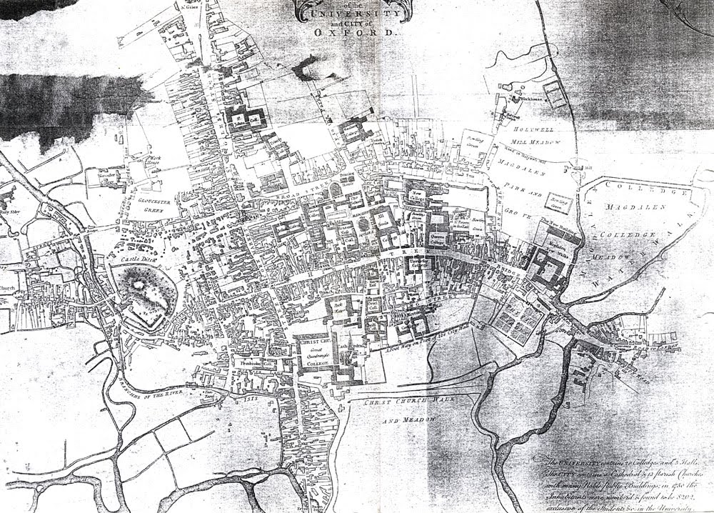
I’ve spent a very interesting morning in the archives at Christ Church college, researching as part of the East Oxford Archaeology Project. I had no fixed idea as to what I wanted to look for but was interested to see where the various material on offer would lead me.

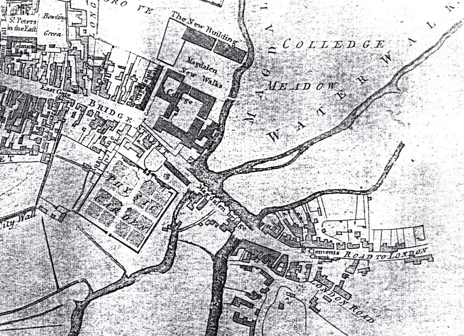
I started by looking at a large and beautiful map of 1777 which showed the field system in East Oxford along with the names of fields and some of the individual furlongs. The abundance of units of measurement are quite baffling but nonetheless very poetic: furlongs, perches, chains, rods etc. and the way locations of land are described equally interesting; for example “The field called the Lakes begins next to Drove Acre Meer shooting onto the Marsh.”

A meer as far as I’ve been able to ascertain is a boundary deriving from the Old English world mǣre. Interestingly, Drove Acre still exists today in the form of Drove Acre Road, which joins with Ridgefield Road, so named after the old Ridge Field on which it’s built. Before I go into other field names, I want to try and identify the different units of measurement.

A rood is a unit describing an area of land and is equivalent to 1/4 acre. An acre is therefore 4 roods. In terms of length, an acre is a furlong (a furrowlong) which is equivalent to 10 chains or 220 yards. A chain therefore is 22 yards. A rod, pole or perch is 5 1/2 yards. A mile is 8 furlongs. 

I also found a unit called a butt, which I believe is where the oxen (ploughing a furlong) turned and rested where one acre butted onto the next creating a small mound of earth. 

The names of the main fields in this area – as I discovered in a document of 1814 – are as follows:

Bartholomew Field
Ridge Field
Compass Field
The Lakes
Broad Field
Church Field
Far Field
Wood Field
Open Field Meadow

The name Far Field makes sense in that it’s situated some way from town. But The Lakes? 

Within these fields, individual furlongs were also given names, such as:

Pressmore Furlong
London Way Furlong
Ridge Furlong
Furlong by the Mead Hedge
Clay Pits Furlong
Furlong Shooting on Breaden Hill
Short Furlong in Catwell
Brook Furlong
Hare Hedge Furlong
Croft Furlong by Bullingdon Green

The word shoot or shooting is used a lot to describe the location of land, such as ‘Furlong shooting on Sander’s Marsh.’ I think this must mean that the furlong joins or abuts the marsh. ‘The furlong that shoots on the alms-house,’ for example seems to describe land that joins the alms-house which I think describes those in St. Clements. 

What interests me is how differently this area of Oxford would have been known to those who lived 200 years ago. It’s an obvious point given that much of what were fields are now houses, but it’s the names that interest. How did these places acquire these names, and why have some survived and others haven’t? (It’s probably just as well that no-one lives in Shittern Corner today).

Filed Under: Oxford Tagged With: 18th Century, Archaeology, Oxford, Place

Map of Oxford 1750

June 24, 2010 by Nicholas Hedges

Although this map was made 20 years before the time which I’m researching, it gives nonetheless a good idea as to what the town looked like before the Mileways Act of 1771.

Magadalen Bridge is on the right hand side of the map, a detail of which can be found below.

The Gentleman’s Servant would have taken what’s described as the London Road at the bottom of the image.

Filed Under: Oxford Tagged With: 18th Century, Gentlemans Servant, Map, Maps, Oxford, Servant

John Malchair (1730-1812)

June 23, 2010 by Nicholas Hedges

I first encountered the work of John Malchair in 1998, at an exhibition in the Ashmolean Museum Oxford. Being as I am from Oxford, I was immediately struck by the beauty of his drawings which revealed through their own delicate rendering, the fragility of vanished places in and around the city.

According to Colin Harrison in the catalogue accompanying the exhibition, John Malchair was ‘the most important and influential drawing master in eighteenth century Oxford’. He was a German violinist who for over thirty years supplemented his earnings as leader of the band at the Holywell Music Room.

The following abridged text is taken from the catalogue; Malchair the Artist by Colin Harrison.

“He was baptised on 15th January 1730, in St. Peter’s Church, Cologne, the eldest son of a watchmaker, Joannes Malchair and Elizabetha Rogeri. They lived together in Sternen Grasse in a house next door to that where the Rubens family spent a difficult period between 1578 and 1587. After leaving his native city, he moved to Nancy and in 1754 arrived in England. Apart from short tours of Wales in his retirement, he never left his country of adoption.

After making his first appearance at the Three Choirs Festival in September 1759, where he was to play annually until 1776, Malchair came to Oxford to compete for the position of leader of the band at the Music Room after the death of Thomas Jackson. He won the competition and made his first appearance at the Widow Jackson’s benefit on 29th November or the choral concert on 12th December.

When Malchair arrived at Oxford, the city was essentially contained within the mediaeval city walls. As the first guidebook to the city – ‘A Gentleman of Oxford, The New Oxford Guide’ published in 1759 describes:

‘The town rises on a broad eminence which arises so gradually as to be hardly perceptible, in the midst of a beautiful extent of meadows, to the south, east and west and cornfields to the north. The vales on the east are watered by the river Cherwell and those on the west and south by the main stream and several branches of the Isis. Both rivers meet towards the north-east. The landscape is bounded on every side, the north excepted by a range of hills covered with woods….’

Walking was a popular pastime in such pleasant surroundings, in the streets, college gardens and father afield to nearby villages, such as Headington in the east, with its magnificent views from Shotover Hill.

Malchair quickly settled into the rhythm of rehearsals and concerts required at the Music Room and took his first pupils for drawing soon after he arrived. In 1760 he married Elizabeth Jenner who died ‘after a lingering illness’ on 14th August 1773. Malchair was deeply affected, and in later years frequently thought of their happy years together.

He died in 1812 and was buried in St. Michael’s church on 19th December 1812.”

In ‘Malchair the Musician’ also in the catalogue, Susan Wollenberg describes how Malchair “developed the idea of collecting tunes ‘on location'”.

“Interspersed with the many items from Playford and other published sources were his own discoveries. Numerous annotations to melodies in the collections… show Malchair’s eagerness in this regard. Beyond the academic and the musical aspects of his work are the pure ‘collector’s instinct’ and delight in acquisition. As Malchair remarked in his vivid English, ‘the leasure howers of many years were employed in forming this collection, ney, necessary busness was at time incrotched uppon when the fitt of collecting Grew Violent.”

Crotch (William Crotch, who, as a ‘Child in a Frock on his Mother’s Knee, performed the organ in the Music Room, to the great astonishment of a large audience’, on 3rd July 1779 – aged three) describes how No.156 of his Specimens was ‘written down by Mr. Malchair, who heard it sung in Harlech Castle’. Malchair himself notes that his version of ‘The Grand Duke of Tuscany’s March’ is ‘as played by a Savoyard on a barrill Organ in the Streets at Oxford. November 30 1784’.

The streets of Oxford were evidently a fertile source. Among the items gathered in the Cecil Sharpe House volume they yielded, besides the March already mentioned, such gems as La Rochelle, ‘played by a Piedmontese Girl on a Cymbal in Oxford Streets December 22 1784’ (and recorded together with Malchair’s instructions for reproducing the effect on the violin); an untitled tune resembling ‘Early One Morning’ transcribed ‘from the Singing of a Poor Woman and two femal [sic] Children Oxford May 18 1784’; a topical item, ‘The Budget for 1785. Sung in the Streete July 21 – 1785 – Oxon A Political Balad on Mr Pit’s Taxes,’ a tune for flute a bec [recorder] and Tambour’ which Malchair heard ‘play’d in the Streets at Oxford Ash Wednesday Feb: 25 1789’; and, most evocatively, the lively ‘Magpie Lane’ tune: ‘I heard a Man whistle this tune in Magpey Lane Oxon Dbr 22 1789. came home and noted it down directly.”

Filed Under: Oxford Tagged With: 18th Century, Gentlemans Servant, John Gwynne, John Malchair, Oxford, Servant

Magdalen Bridge c.1772

June 23, 2010 by Nicholas Hedges

The image below is a drawing of Magdalen Bridge made around 1772 by the German artist John Malchair. Following the passing of the Mileways Act in 1771, Malchair made a number of studies of the old bridge so as to record it for posterity.

With various parts of the mediaeval city threatened because of the Act, Malchair drew a number of views of buildings and structures including the North Gate and Bocardo Prison and Friar Bacon’s study which eventually fell in 1779.

This then is the bridge over which The Gentleman’s Servant crossed with two horses on December 12th 1770.

Filed Under: Oxford, The Gentleman's Servant Tagged With: 18th Century, Gentlemans Servant, John Gwynne, John Malchair, Oxford, Servant, The Gentleman's Servant

John Gwynn’s Survey 1772

June 23, 2010 by Nicholas Hedges

Remarkable evidence of those who lived in Oxford around the time the notice appeared in Jackson’s Oxford Journal can be found in a survey carried out by John Gwynn in 1772 (John Gwynn also designed the new Magdalen Bridge). Made as part of continuing improvements originating with the Mileways Act of 1771, the actions of Gwynn (who could be seen around town measuring the fronts of houses and other buildings) aroused suspicion and even alarm among the city’s residents. The survey itself was required to calculate the costs of repaving the city’s streets for which each property was liable to pay a share depending on the size of their facades. What we have as a result is a wonderful record; a long list of names of all the city’s residents (or rather property owners), the streets on which they lived (or owned property) and the size of their dwellings – given in yards, feet and inches. It’s interesting for me that among the many Stevenses listed in the survey might well be my great-great-great-great-great-grandparents.

The page reproduced below, is taken from the survey and represents the bottom end of the High Street where it meets Magdalen Bridge – the Bridge can be seen listed below the name of a Dr. Sibthorpe. The Physick Garden above, is the old name for what is now the Botanic Gardens.

See also John Gwynn’s Survey 1772 – Part 2.

Filed Under: Oxford, The Gentleman's Servant Tagged With: 18th Century, John Gwynne, John Malchair, Oxford, Survey, The Gentleman's Servant

Magdalen Bridge

June 23, 2010 by Nicholas Hedges

The bridge over which our Gentleman’s Servant rode in December 1770 is not the same bridge which crosses the River Cherwell today. Being as it is an important part of the story, I’ve copied an entry on the bridge from The Encyclopaedia of Oxford1 which I’ve reproduced below.

A bridge, formerly known as Pettypont and East Bridge, has stood here since at least 1004. In the Middle Ages the cost of its upkeep was shared between the county and the town, the town meeting its three-quarters share largely by alms and charitable bequests, the maintenance of bridges being then considered a pious duty. Bridge-hermits were also appointed to help travellers with any difficulties they might experience in crossing. The original bridge was of wood, but by the 16th century a stone bridge, some 500 feet long, with about twenty pointed and rounded arches, had been constructed.

At this time the city was still paying for repairs, both by taxation and by the allocation of alms; but William of Waynflete, the founder of Magdalen College, may have paid for restoration of the bridge in the 15th century, and the University certainly did so in 1723. Although a major restoration was then undertaken, less than fifty years later some of the piers had been swept away by floods and the western end had collapsed completely. Condemned as dangerous, it was rebuilt between 1772 and 1778 under the provisions of the Oxford Improvement Act of 1771, to the design of John Gwynn. At the same time a toll-house was built at The Plain, with gates across the roads from Headington to Cowley to collect dues for the maintenance of the bridge. Twenty-seven feet wide, with recesses in the middle, the bridge’s large semi-circular arches were supplemented by smaller ones over the towpaths. The plain balustrade was designed by John Townesend after plans for a more elaborate one had been dropped. The bridge was widened in 1835 and again in 1882. Notabilities have frequently been welcomed or taken their official departure at the bridge, as Queen Elizabeth I did on leaving Oxford in 1566.

1 The Encyclpaedia of Oxford, 1988, Ed. Christopher Hibbert, Assoc. Ed. Edward Hibbert; London, Macmillan London Limited

Filed Under: Oxford, The Gentleman's Servant Tagged With: 18th Century, Gentlemans Servant, John Gwynne, John Malchair, Magdalen Bridge, Oxford, Servant, The Gentleman's Servant

Mr Stevens

August 11, 2009 by Nicholas Hedges

A year or so ago, I started work on a piece of work based around John Gwynn’s survey of 1772. The piece was called (as a working title) ‘6 Yards 0 Feet 6 inches’ based on the measurement of John Malchair‘s home in Broad Street. Having discovered an ancestor – John Stevens – born in the city in 1811, I wondered if there was any chance that one of the Mr Stevens’ listed on the survey was an ancestor of mine? It seemed a long shot but after today’s research I’m rather more optimistic.

If I did have an ancestor in Oxford at the time of the survey and if my research is correct, then that ancestor would be John Steven, the grandfather of the one previously mentioned. I’ve no idea when he was born but I do know that he was married in 1764 and is described as coming from St. Martin’s Parish, where his son Samuel, John Jr’s father was baptised in 1776. One could assume therefore that I did indeed have ancestors living in the parish of St. Martin’s at the time of the survey.
The images below are taken from the survey and show two Stevens one of which might well be my ancestor.

Gwynn fails to include (at least on the copy I have) first names from the survey but within the parish of St Martin’s two Mr Stevens are recorded along with a Mrs Stevens. One can assume however, that those most likely to be mine are the two Mr Stevens mentioned as living in the parish, one in Butcherrow (now Queen Street), the other in North Gate Street (now Cornmarket). The residence in Butcherrow is 7 yards 0 feet and 6 inches. That in North Gate Street is 4 yards 2 feet 0 inches.

John Gwynn's Survey 1772

John Gwynn's Survey 1772

Of course more work is required to see if one of these is indeed my ancestor, but I must admit to being very inspired by the prospect.

Filed Under: Oxford Tagged With: 18th Century, Family History, Family Stevens, John Gwynne, Oxford, Stevens, Survey

Old Newspapers

August 8, 2009 by Nicholas Hedges

I’ve just spent the afternoon in the library reading through a selection of old newspapers from 1771/2 along with numerous copies from the ninetheenth century. I was hoping, initially, to find anything mentioning a Mr. Stevens, Tailor as in a survey of the city (1772) made by John Gwynn several Stevens are listed. As my ‘several-greats’ Grandfather was born in Oxford in 1811 and was a tailor, I wondered whether one of these might be a relation. Anyway, unsurprisingly I found no such mention, but what I did find were a few tantalising glimpses into the 18th century city.

The first is the theft of some lead on October 11th 1771:

“Whereas a considerable quantity of lead has been stolen from off the gate of the physic gardens’ opening into Rose Lane. This notice is given that whosoever will give information to the Rev.Dr. Wetherell, Vice Chancellor, so that the offender or offenders may be brought to justice, shall upon his or their conviction, receive a reward of five guineas.”

Whether or not the guilt party were ever brought to book I don’t know. A couple of weeks later, another audacious theft occurred, this time in Holywell Street:

“Whereas on Monday the 21st of this instant October 1771, the iron rails to the steps of Mrs. Wise’s house in Holywell were taken away. This is to give notice that if any one will discover the offender or offenders so that they may be brought to justice, shall, on his or their conviction receive half a guinea reward from Francis Kibblewhite in Holywell.”

Looking at my 1772 survey, I see that Mrs. Wise lived at what is now called No.2 Holywell Street. Mr Kibblewhite lived at what is now No.38.

Following a burglary on November 8th 1771 in Old Butcher Row (modern day Queen Street) the reward offered for information was much more tempting – provided of course, one had information with which to complete any deal, and thus be tempted to impart.

“Whereas the dwelling of Mr. John Greenway situate in the Old Butcher Row, in this city was last night broke open and divers sums of money and other valuable effects stolen thereout. Notice is hereby given that if any person or persons will discover the offender or offenders so that he, she or they may thereof be committed, he shall receive the sum of fifty guineas from me.”

This very large amount of money (a guinea was equal to £1 1s) was offered by Francis Greenway. The following week on November 16th, the news appeared again with an addendum:

“N.B. It is discovered that a plain round gold snuff box and eight gold rings, chiefly Mourning ones belonging to the family were at the same time taken away.”

The following week this appears, just below the same story repeated for the third week and addressed ‘To the Publick’:

“Whereas some evil designing persons have maliciously propagated various infamous aspersions which tend to injure our characters relating to the late robbery committed at Mr. John Greenway’s home in old Butcher Row; in order to vindicate and clear ourselves of the said aspersions, we did severally make oath that we were not in any wise directly or indirectly concerned in the said robbery or have any knowledge of the person or persons who committed the same, and we do declare that the said aspersions so far as they tend to lessen or injure our reputations and characters are totally false.”

The letter is signed again by Francis Greenway although whether he is including himself as one of the aggrieved I’m not sure. Below his name are the names of two servants, Mary Staunton and Jane Carpenter who made their oath before the Mayor, John Austin. Francis Greenway offered a further 5 guineas to whosoever gave information leading to the conviction of the slanderers which he increased to 20 guineas later on. This was not the end however. On December 7th 1771 when the same story appeared with the same letter to the publick beneath, Francis Greenway wrote:

“And as it is apprehended more than one person must have been concerned in the above burglary, this further notice is given that any one giving information against his accomplice or accomplices shall be paid the above reward of 50 guineas upon his, her or their conviction and will likewise, upon being admitted evidence, be entitled to a Free Pardon.”

That was still not the end of the matter. On December 21st, he added that the reward of 50 guineas was “besides the forty pounds allowed by parliament for me.”

These notices or stories were printed every week and did not stop being printed until March 21st 1772. Whether anyone was brought to justice I don’t know.

Perhaps the most enigmatic story or notice I read however was that printed on February 8th 1771.

“Whereas a person (supposed to be a Gentleman’s Servant) went out of Oxford, December 12th 1770 over Magdalen Bridge and took the Watlington Road riding a horse with a long tail and leading another with a cut tail on which a Portmanteau was tied: whoever recollects seeing the same person and can give information of his name and place of abode so that he may be spoke withal, shall on such proof receive half a guinea reward from the printer.”

Not exactly 50 guineas, but a very curious notice which has left me, as have the stories above, with so many questions. Who stole the lead and Mrs. Wise’s railings? Who carried out the robbery in Old Butcher Row – was it an inside job? And who was the man on the horse, leaving the city over Magdalen Bridge in the winter of 1770? Time – as far as I’m aware – hasn’t told so far. So, maybe I will.

Filed Under: Oxford Tagged With: 18th Century, Gentlemans Servant, History, Newspaper Cutting, Oxford, Servant

Abingdon Road

September 1, 2008 by Nicholas Hedges

One of my favourite drawings is that made by a German-born, Oxford-based artist called John Malchair, who lived and worked in the city in the late 18th century. The drawing shows a view of the Abingdon Road as it appeared in 1770 with the strange and imposing edifice of Roger Bacon’s study in the foreground – a building that was demolished nine years later – and the familiar, extant structure of Christ Church College’s Tom Tower behind.

There’s something beguiling about the image, depicting as it does the city long before the car, before its expansion into the suburbs when still surrounded by fields and meadows. It’s a quiet almost pastoral scene in which I feel I can hear the birds and feel the sun on my face. I can almost hear the quietude, contrasting it with the sounds I would hear today if I stood in a similar position; indeed, it’s an image in which I am constantly contrasting, moving back, to and fro between the past and the present.

This contrast between the past and present is what I experience as I research my family tree and this image I’ve lately realised embodies some of my recent thinking and research. My great-great-great-great-grandfather, Samuel Stevens, born in 1776, lived and worked as a tailor on St. Aldates in Oxford, a street which is in effect a continuation of Abingdon Road as it moves towards and connects with Carfax in the city centre. I like the fact that he is contemporary with this image and would have been alive (if only a small boy) when Roger Bacon’s study was still standing.

On the other side of my family tree, on my father’s side, my great-great-great-great-great-grandfather, William Hedges lived and worked in Abingdon, a town in which his line lived until George Hedges moved to Oxford sometime around 1869 when he married Amelia Noon, daughter of Charlotte Noon, murdered by her husband Elijah in 1852 (see ‘A Murder in Jericho‘). It’s very likely of course that both these lines (the Stevens’ and the Hedges’) continued back in those same places (Oxford and Abingdon) for further generations, and I like the fact that in this image by Malchair, and in a sense in the building he drew, is a connection between the two. Not only that, there is a connection between my past and my present, as if that connection might be found in the road between Oxford and Abingdon.

Finally, in a project I started some time ago (6 Yards 0 Feet 6 Inches) I make mention of a survey by John Gwynn, carried out in 1771 in which all the residents of Oxford are listed along with the measurements of their properties. It’s a fascinating document in its own right, but if Samuel Stevens’ parents lived in Oxford just a few years before his birth, they would be listed in that survey. Flicking through there are a number of Stevens’ and I can’t help but think one of them is my ancestor.

Filed Under: Oxford Tagged With: 18th Century, Drawings, John Gwynne, John Malchair, Oxford, Survey

6 Yards 0 Feet 6 Inches III

April 6, 2008 by Nicholas Hedges

Following up the work I have done so far with the composition based on John Gwynn’s survey, I have decided to do the same with video. This follows on from work I have done on Tour Stories/Umbilical Light, projects based on photographs taken in Oxford around the turn of the 19th/20th century.

I’m not sure yet what the images will be within each, but I think it will be something along the lines of the photographs I have been using.

Filed Under: Uncategorized Tagged With: 18th Century, 6 Yards 0 Feet 6 Inches, John Gwynne, Sonic Work, Survey

6 Yards 0 Feet 6 Inches II

April 2, 2008 by Nicholas Hedges

Having converted the distances for each dwelling/building into seconds, I created a new track in Cubase and added markers for each of the sections, creating as a result a sonic image for the southern side of the High Street as it appeared in 1772. Below is a detail of a larger screenshot. Click on the image to open a new window with the larger image.

I’m not sure at this stage how I will proceed with the score, but I have added a note (C3) at each marker point which is at least a start. These can be seen in the two midi tracks beneath; the first track a short note, the second row the length of the interval between them. Listening – whilst it doesn’t make for an interesting sonic encounter – does at least allow the listener, in this case me, to get a sense of physical space of the street from the duration of the notes (in the case of the second midi track) or the duration between each (as in the case of the first).

Filed Under: Uncategorized Tagged With: 18th Century, 6 Yards 0 Feet 6 Inches, John Gwynne, Sonic Work, Survey

John Malchair and Henry Taunt

March 22, 2008 by Nicholas Hedges

Over the course of the past few months I have been looking in some detail at the works of two people who one might say are connected, John Malchair (1730-1812) and Henry Taunt (1842-1922). Malchair was an 18th century German-born musician and artist who lived most of his life in Oxford, and Henry Taunt, a photographer who worked in the city at the end of the 19th/beginning of the 20th centuries. Although separated by almost a century and using very different media, their work nonetheless leaves us with a tantalising record of things that have long been lost.

Malchair, through his drawings (and too, his collection of music heard on the streets of the city) recorded the city in the years prior to and after the 1771 Mileways Act which saw much of the old town demolished. It is because of his work that we have visual records of so much that was lost, in particular – for me at least – Friar Bacon’s study, the strange and beguiling edifice which one stood on Folly Bridge in the south of the city and which was demolished in 1779.

Henry Taunt also recorded through his photographs much of the city which has in the years since been demolished. But more significantly are the images of people caught within these photographs like flies in prehistoric amber. Faces look up at us from beyond the grave, heads are turned away from us in the distance (the other end of the street becomes a hundred years away). Through the work of Taunt we are afforded a glimpse of moments which have been swallowed up in the course of history just as moments are swallowed now in the course of an average day. It is these ordinary moments which we recognise and which make the past and present so readily interchangeable.

Filed Under: Uncategorized Tagged With: 18th Century, Henry Taunt, John Malchair, Mileways Act, Mileways Act 1771

Memory – The Poor Draughtsman II

March 22, 2008 by Nicholas Hedges

Following on from my last entry on the subject (Memory – The Poor Draughtsman) I thought back to the ruined church I saw in Berlin, the Kaiser-Wilhelm Memorial church.

For me, the tower is just what the memory of a building is; a ruin of sorts, one which in part has been reconstructed by the brain to make an image which best approximates reality. Its edges are indistinct, the stone is vague and the fabric a hotchpotch of different materials no doubt rescued from the rubble. Whenever we think of a place we know – for example a building – we build – or rebuild – anew in our minds every time we think of it, constructing the remembered thing from whatever we can find.
The following image is a quick Photoshop sketch which takes the idea of the remembered ruin by blending an old map of Oxford (1750) with the image of the contemporary city as a ruin (aerial view) which I made recently. A more finished piece might leave those buildings still extant intact and blend in fully the areas which have been completely destroyed or altered.

Looking at this, and considering ideas of memory and draughtmanship, I was reminded of the work of Arie A. Galles who has made fourteen large scale drawings of aerial photographs taken over death camps during the second world war. I first discovered his work when studying the death camp at Belzec and have now begun to understand or interpret his work in a different way.

For him, memory is no ruin, it is as sharp as a photograph taken from the skies. But there is it seems a difference between the memory of a place and the memory of people. In the image of Belzec (above) something has been obscured, hidden, buried. It is a piece of text, the fourth verse of the Kaddish; a prayer said for the dead. Perhaps then, we should read this image as a warning, that this place of trauma will always be there, but is victims are gone; there is always the risk it seems of forgetting.
What is also interesting for me about Galles’ work, is the fact the drawings are made using charcoal. There is something about it (something it shares with coal), which gives the drawings of Galles’ extra poignancy; something living, now dead is used to make something new – it creates. I mention coal as I have in light of my work on my family tree, in particular with regards my great-grandfather Elias who worked in the coal mines of South Wales, been considering making drawings using coal. The images of the ruined city, the areial photographs and the black and white photographs I’ve been looking at of people long dead all point to my looking more closely at this idea.

Filed Under: Oxford Tagged With: 18th Century, Arie a Galles, Berlin, Map, Memory, Oxford, Ruins

6 Yards 0 Feet 6 Inches

March 22, 2008 by Nicholas Hedges

I’ve started to consider ways in which I might use John Gwynn’s survey of 1772 as a basis for a score and after various ideas decided the best place to start was – obviously – with the measurements Gwynn recorded; measurements of the size of properties in the centre of the city.

The following is an image taken from a reproduction of the survey, showing Gwynn’s statistics of 1772, and those taken in 1911 for Holywell Street.

For the moment I have decided to concentrate on the south side of the High Street and have reproduced the stats for this part of the city which can be downloaded as a PDF. After various attempts at translating the measurements into time so that the score might be structured in this way, I finally came up with the following method: the yards and feet I converted into inches (36 inches in a yard, 12 inches in a foot). I added the remaining inches and then converted back into yards (the idea was to end up with a figure or figures that most resembled time, e.g. 10.789 seconds). So for example; Mr Brockis owned property on the south side of the High Street which was 14 yards, 2 feet and 4 inches in length. By using the wonders of Excel, I ended up with a figure – through calculating with the above formula – of 14.77777778 yards, which although was more like the period-of-time-type measurement I was looking for made me feel uneasy; there was something about decimal points and imperial measurements which didn’t add up so to speak. The obvious thing therefore was to convert this sum (14.77777778 yards) into centimetres, which in another column of my ever-expanding spreadhseet I did by multiplying the sum by a factor of 91.44. Mr Brockis’ propery therefore came out as being 1351.28cm in length, or 13.5128 metres. Much better; I had my figure.

The next thing to do was to take these seconds and see how long the composition for the south side of the High Street would be. Again using Excel, I calculated that the entire piece would last 13 minutes and 32 seconds and today I decided to try it out. Armed with a stopwatch I walked the length of the street (in quite appalling weather) and found that at a reasonable, ambling kind of pace, it took me about 10 minutes 25 seconds. Although not quite 13 minutes 32 seconds (others would of course walk much more slowly) it nonetheless means that any following composition is imbued with a sense of space; the music (whatever the music will come to be) will liaise directly with a walk through the city.

Filed Under: Uncategorized Tagged With: 18th Century, John Gwynne, Survey

John Gwynn Survey

March 3, 2008 by Nicholas Hedges

I have for a long time been interested in John Gwynn’s survey of 1772, carried out in reponse to the Paving Commission’s desire for improvements to the city. In ‘A History of the County of Oxford: Volume 4’ (Victoria County History), it states in the opening paragraph on ‘Modern Oxford’ that ‘…With the Paving Commission of 1771 Oxford’s modern history began…’ and that ‘…The enthusiasm for public improvements alarmed some householders, particularly when the Paving Commission’s surveyor, John Gwynn, was observed all over town, measuring and making notes on streets and houses.’

For a long time I have wanted to work with the survey, being particularly interested in the list of names and associated measurements of the spaces they occupied in the eighteenth century city; people who of course have long since disappeared.

I had looked at it in relation to some work I did as part of my residency at OVADA in April/May last year. Firstly, regards a painting called Gloucester Green to Broken Hayes:

The title ‘Broken Hayes’ is the old name for Gloucester Green and describes a place which, in a sense, no longer exists, although, like the ghostly dwellings on John Gwynn’s survey (1772) it’s ‘footprint’ is still visible in the boundaries of the Green. Many of the items rubbed out on the canvas no longer exist in the places where I ‘found’ them; they are, in name only memories, just like Broken Hayes, yet like the physical aspect of that place, they still exist.

Then the walk I made from which the painting derived:

This isn’t an area I know that well – I’m not sure if I’ve ever walked the entire length of Paradise Street – and yet afterwards, when I looked at David Loggan’s map of 1675, it all seemed very familiar. I was surprised at how much was left after the upheaval of redevelopment, particularly when standing near St. George’s tower, near the junction of St. Thomas’ and Paradise Streets. Now, looking at John Gwynn’s surveys, I could make much more sense of the Oxford of 1772.

In another entry I wrote:

“But the layout of the streets (if not the buildings and their inhabitants) still remain, and so, by walking these streets, armed with a residual list of measurements, one can walk back in time and make a connection with this vanished population.This correlation between time and distance had initially come through my thinking of how difficult it often is, to identify with people who live abroad in war-zones (Iraq and Afghanistan for example), for, even though these countries are only a comparatively short distance away, they might as well be years in the past, for it’s almost as difficult to relate to those who live (and die) there, as it is to those who lived and died, for example, during the first and second world wars, or the time of John Gwynn.”

However, in light of the recent work I have made as part of the Brookes show at MAO, my ideas have changed a little. Thinking back to some thoughts I had on the Three Fates, I’ve decided to try merging the two ideas. One aspect of the story of Gwynn I liked particularly was the idea of residents being worried by his measuring, as if he was measuring up the fate of their homes and the city as a whole. So, I’ve decided to take these measurements, and using string and a ruler, measure out the string and cut them according to the survey. Mr Pepal would therefore be 12 yards, 1 foot and 9 inches.

Filed Under: Oxford Tagged With: 18th Century, John Gwynne, Oxford, Survey

Imagination and Memory

April 6, 2007 by Nicholas Hedges

Like many others, my imagination has played a central role in my life ever since I was a young boy, and recently, in connection with my recent work, I’ve been thinking about that role and how it has changed as I’ve grown up. As a child, I lived much of my life within imagined worlds; fictional countries which I would map and for which I would create entire histories. I would inhabit these places, hidden from everyone else, and while I walked, I would be walking not in the real world, but in my mind. I can still to this day remember one particular map in all its detail; the mountain ranges, the plains, the forests which were always a particular favourite of mine. I can even list the names of the towns and cities (Aquidos, Anasrehlon, Varimeere), yet while this ‘place’ has remained unchanged, whilst my imagination as a place is only a little different (one might say that the country I created was a map of my mind) the uses made of my imagination have altered. As a child I imagined the imagined, as an adult I imagine reality, and often the unimaginable.

Going back to my childhood, my imagination provided me with a means of escape (not that I needed to escape anywhere – I was fortunate enough to have the perfect upbringing). I’d always wanted to see the world unspoilt, an Arcadian vision without cars, planes, pollution, machines or any trace of the modern. And in a sense, this is I believe, what first fired my interest in the past. As a child and well into my teens – and perhaps early twenties – my interest in history ended at the late 17th century, certainly well before the Industrial Revolution, when the modern world began to develop and my vision of a rural Arcadia began to collapse. In some ways, my imagined world was a pick of the best bits of the (somewhat idealised) past; the ancient sprawling forests, beautiful timber-framed houses. When I looked at an old pair of 16th century shoes, a bottle from a 17th century tavern, I was picturing their place in a comparatively unspoiled landscape.

Of course, as a child, my impressions of the past were, as I said, somewhat idealised; they were little more than romantic impressions of an untamed idyll. In reality of course, the past, at least on a human level was, I came to understand, far from romantic; life was short, harsh and often brutal. So as I grew older, and while I still used my imagination to find my way back into the past, I didn’t imagine the imagined, but rather, as I said earlier, the unimaginable: the reality of the lives of others.

In recent years, this change in emphasis has seen the boundaries of my interest in history widen to include the twentieth century; in particular the unimaginable horrors of the Holocaust and the slaughter of World War One. Yet although these very difficult subjects are far removed from the invented landscapes of my childhood, my memories of maps and the stories created within them, provide an interesting, and I believe vital counterpoint to my understanding of such subjects. One of the problems with studying the Holocaust (and indeed World War One) is not only the sheer scale of the suffering, but also the fact that often the victims of both are, in the eyes of history, just that: victims. To say otherwise, i.e. to say that they weren’t only victims, is not to take away from the terrible suffering they endured, but rather to emphasise it, to focus our minds; they weren’t only victims, they were people with lives both behind them and ahead of them; pasts that for many were happy. They all had childhoods, and perhaps imagined their own fantasy worlds. Many, caught up in the Holocaust, were still inhabiting them – they were still of course, children.

As I’ve said, as a child, I would walk and imagine myself in my invented landscape, but as I grew older, although I still walked and imagined myself elsewhere, it wasn’t within an invented world that I walked, but rather a real world; that of my home town, Oxford’s past. Of course one might argue that this past was a much a fabrication as the map I drew as a child, but nevertheless, it was constructed from fragments of the past – drawings, paintings, descriptions in books, photographs. I could never know for sure what things looked like, or how it must have been to walk through the city’s streets (for example during the 14th century) but my imagination did its best to conjure a picture. Of course, as well as those things listed above, there are parts of the city which are contemporary with the past and these buildings and streets are particularly important when looking for that which has long since gone; just as I have found in Auschwitz-Birkenau and Ieper.

One man who did so much to capture Oxford before much of its past was demolished in the late 18th century was a German artist and musician called John Malchair. His drawings are amongst the most beautiful and indeed haunting images of a city I have seen, particularly his views of Friar Bacon’s study, an unusual edifice which was sadly demolished in 1779.

One particularly poignant drawing (below) shows the remaining arch, when all above it has been taken down.

In my mind, as I walk, I suppose one might say I am often trying to rebuild Friar Bacon’s Study. Walking as a means of remembering then is important to me although it does throw up interesting philosophical questions (which I’ve touched on before) namely, what is it we are remembering when we ‘remember’ events which we ourselves have not experienced. As Paul Ricoeur asks in his book, ‘Memory, History, Forgetting,’ ‘Of what are there memories? Whose memory is it?’.

The invented world I ‘walked in’ as a child was a fiction, an amalgam of all the fragments of an unspoiled landscape which I could see in parts around me. And, in a sense, when ‘remembering’ the past of Malchair’s Oxford, the Great War and the Holocaust, I am creating a fiction of sorts – a world created from fragments; photographs, drawings, letters and documentary evidence. The past becomes my imaginary world.

So what is it which separates the past and my past imaginary landscapes? It is this: it is the theme of this residency; Residue.

Filed Under: Artist in Residence Tagged With: 18th Century, Artist in Residence, Holocaust, Imagined Landscapes, John Malchair, Memory, Paul Ricoeur, Residue, WWII, Ypres

© Nicholas Hedges 2006-20

Subscribe
  • Facebook
  • Instagram
  • Twitter
  • YouTube

Copyright © 2023 · Outreach Pro on Genesis Framework · WordPress · Log in