Nicholas Hedges

Art, Writing and Research

  • Amazon
  • Behance
  • Facebook
  • Instagram
  • Pinterest
  • YouTube
  • Art
    • Digital
    • Drawing
    • Grids
      • Correspondence
      • The Wall
      • The Tourist
    • Ink on paper
      • Shadow Calligraphy
    • Installation
      • Murder
      • Echo
    • Painting
    • Patterns
    • Mixed Media
    • Photographic installation
      • St. Giles Fair 1908
      • Cornmarket 1907
      • Headington Hill 1903
      • Queen Street 1897
    • Research/Sketches
    • Stitched Work
      • Missded 1
      • Missded 2
      • Missded 3
      • Missded 4
    • Text Work
  • Blogs
    • Family History
    • Goethean Observations
    • Grief
    • Light Slowed But Never Stilled
    • Lists
    • Present Empathy
    • Shadow Calligraphy
    • Trees
    • Time
    • Walking Meditations
  • Video
  • Photography
    • Pillars of Snow
    • Creatures
    • The Trees
    • Snow
    • St. Giles Fair 1908
    • Cornmarket 1907
    • Headington Hill 1903
    • Queen Street 1897
    • Travel
  • Illustration and Design
  • Music
  • Projects
    • Dissonance and Rhyme
    • Design for an Heirloom
    • Backdrops
    • Shadow Calligraphy
  • Exhibitions
    • A Line Drawn in Water
      • Artwork
    • A Line Drawn in Water (Blog)
    • Mine the Mountain 3
      • Artwork
    • Mine the Mountain 2
      • Artwork
      • The Wall
    • The Woods, Breathing
      • Artwork
    • Snow
      • Artwork
    • Echo
      • Artwork
    • Murder
      • Artwork
    • The Tourist
    • Dreamcatcher
    • Mine the Mountain
      • Artwork
      • The Tourist
    • M8
    • The Gate
    • Creatures
      • Artwork
    • Residue
      • Artwork
    • A visit to Auschwitz
      • Artwork
  • Me
    • Artist’s Statement

Glimmerings: The War Poets, Paths and Folds

October 16, 2012 by Nicholas Hedges

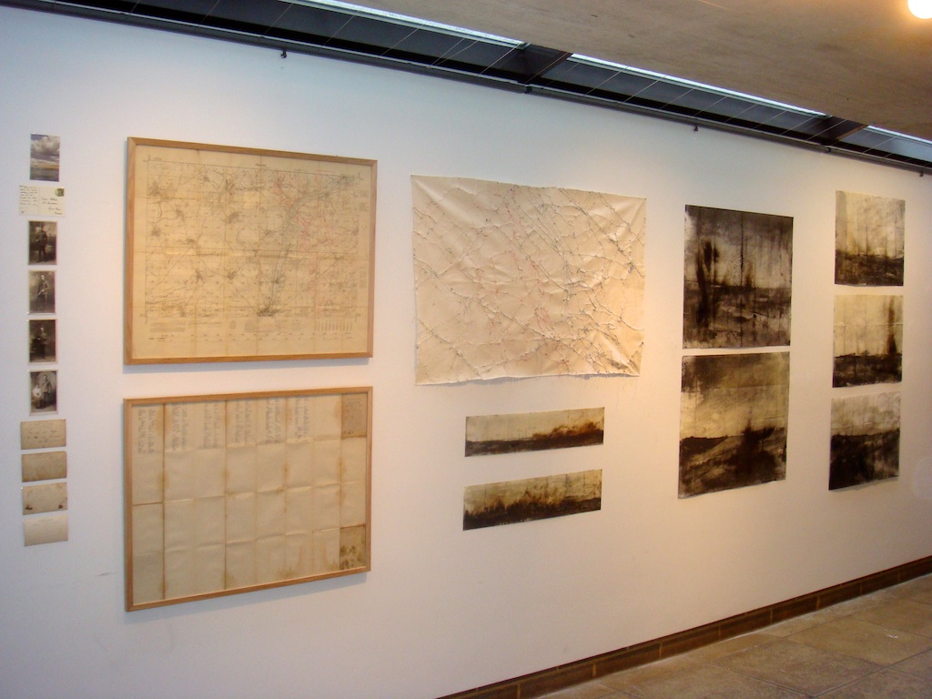
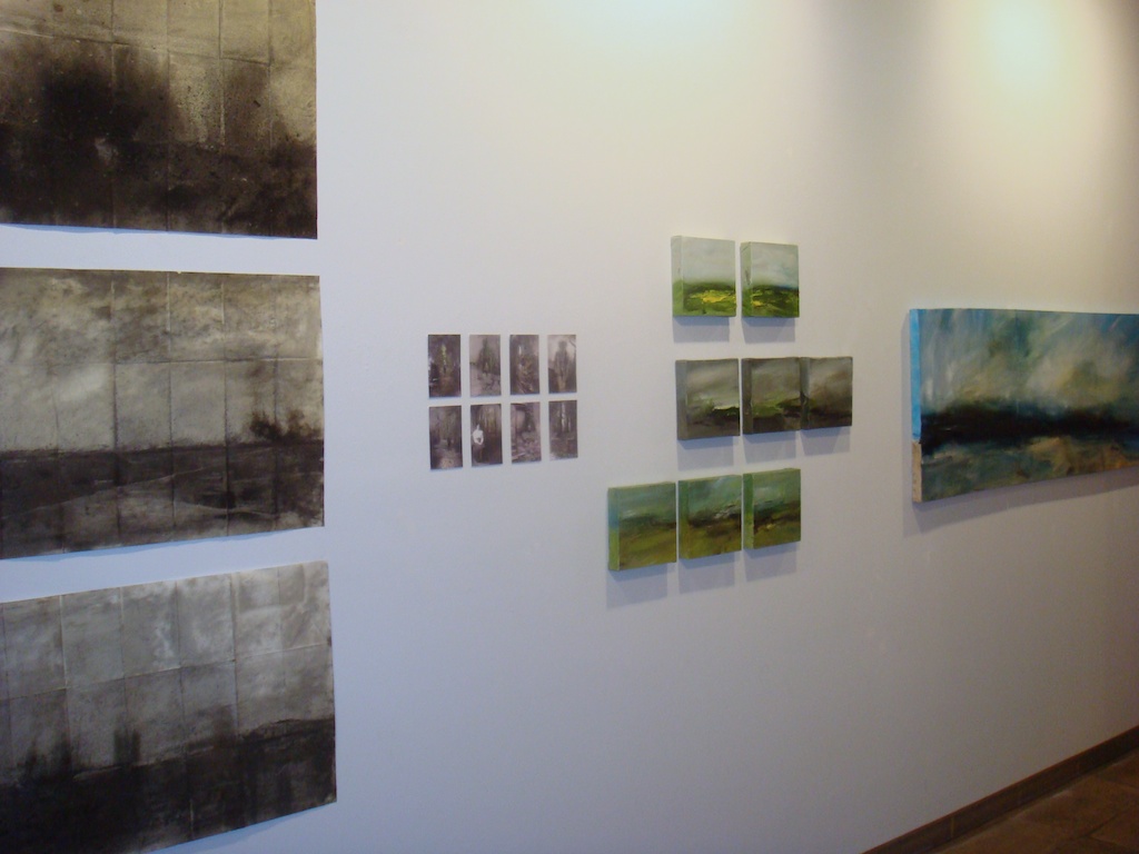
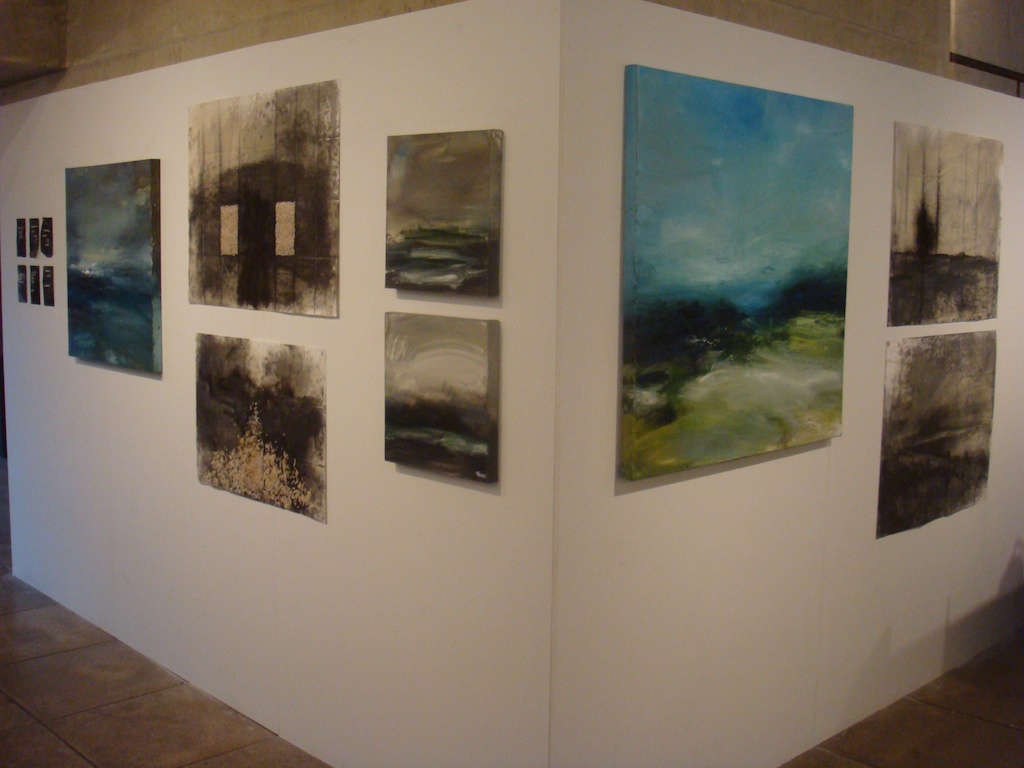
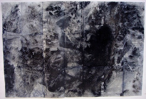
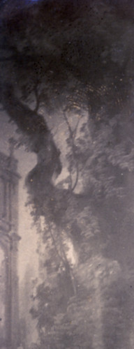
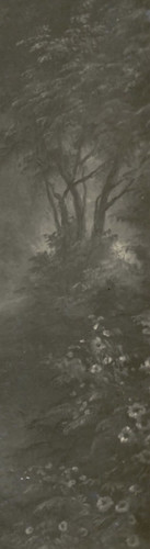
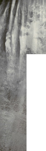
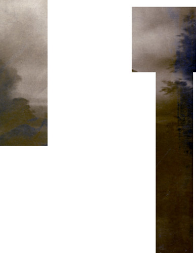
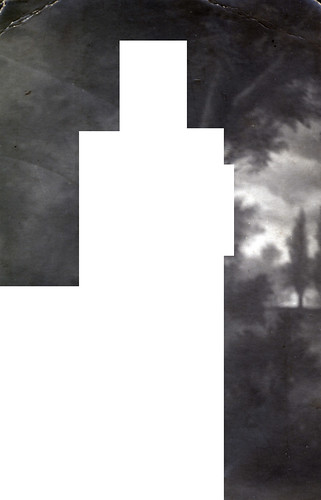
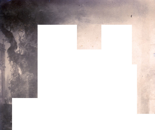
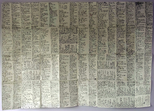
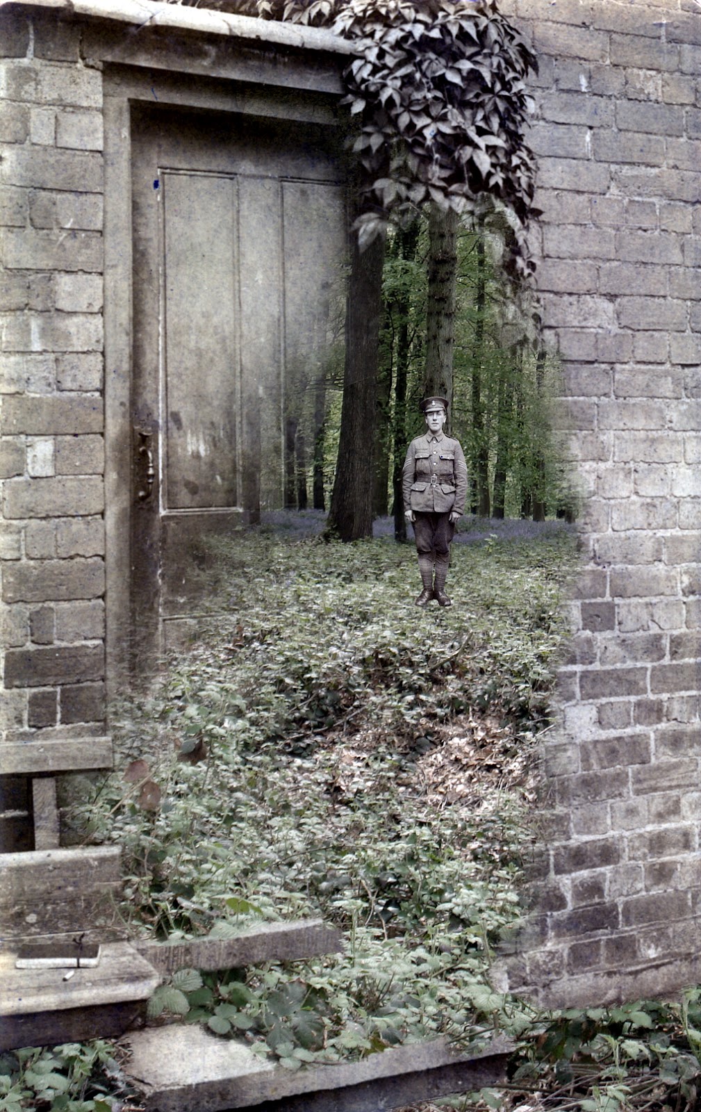
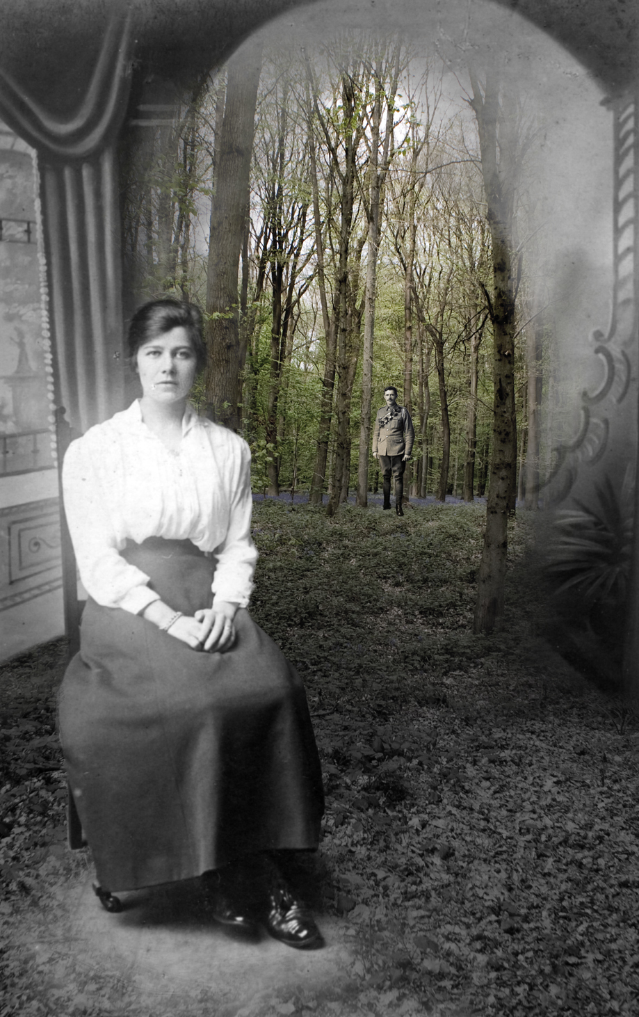
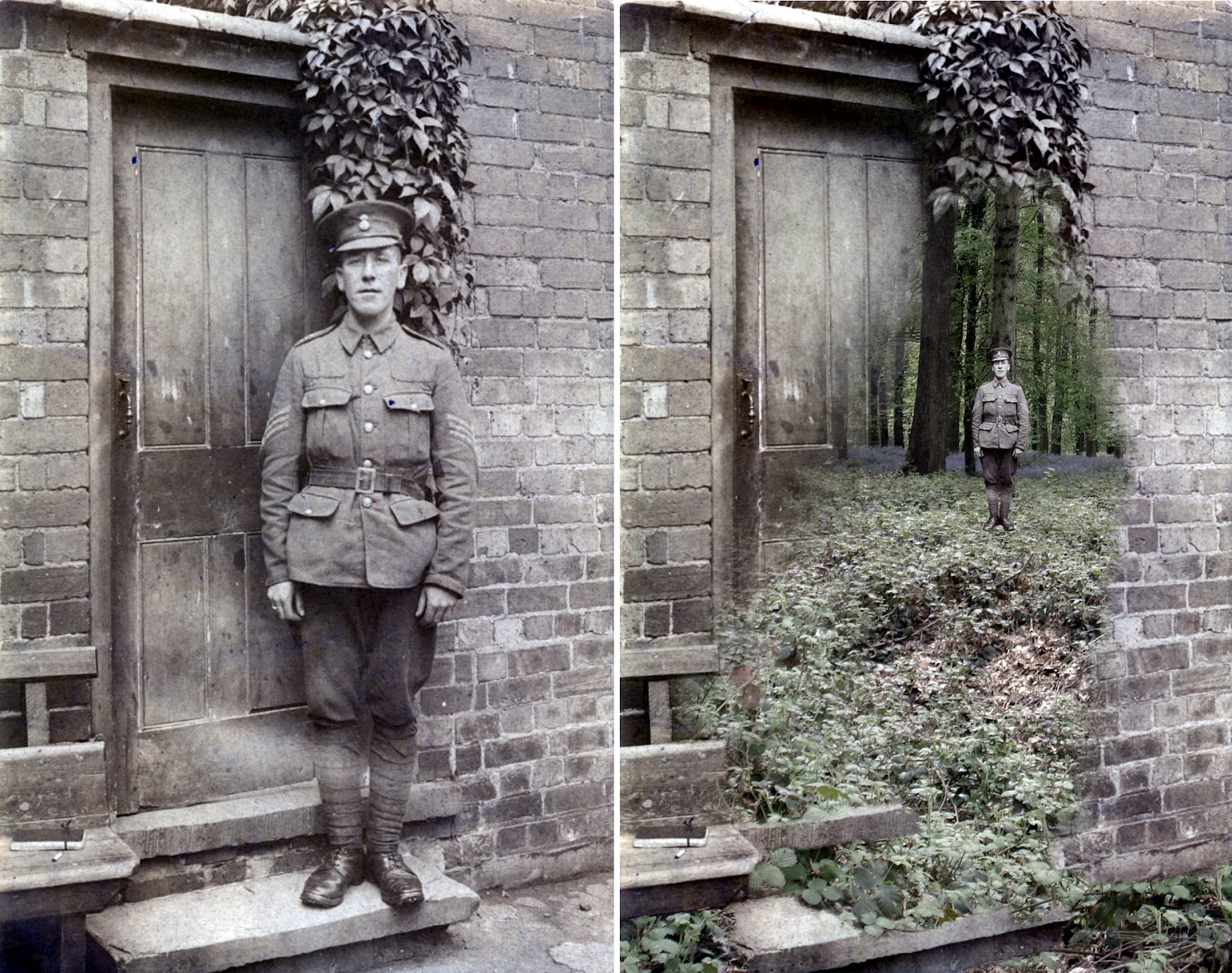
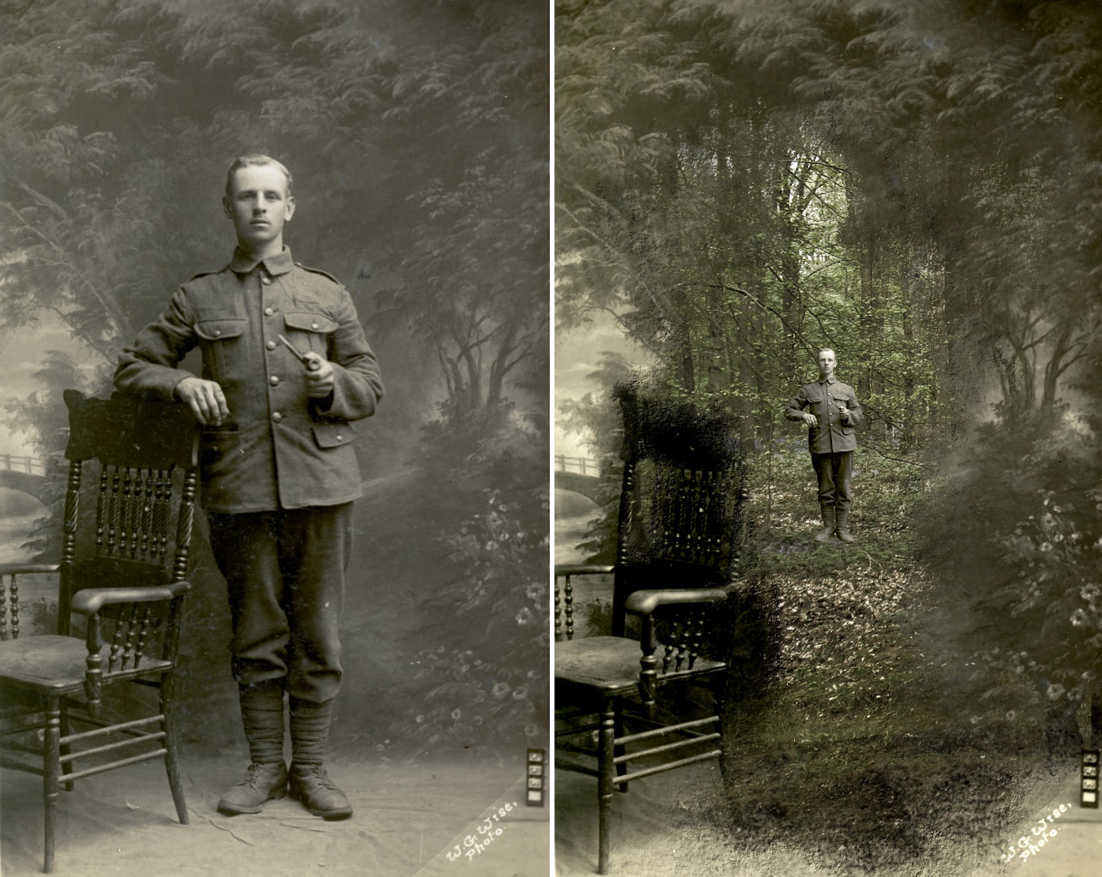
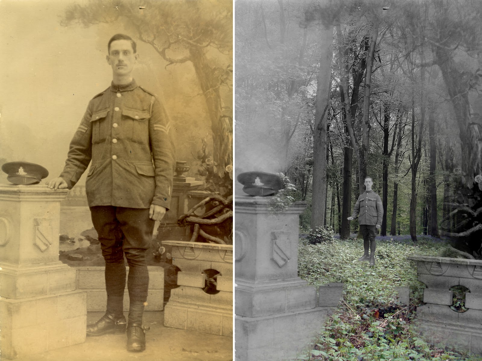
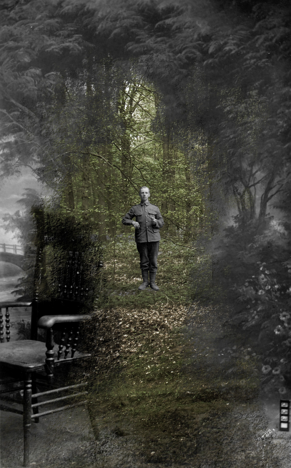
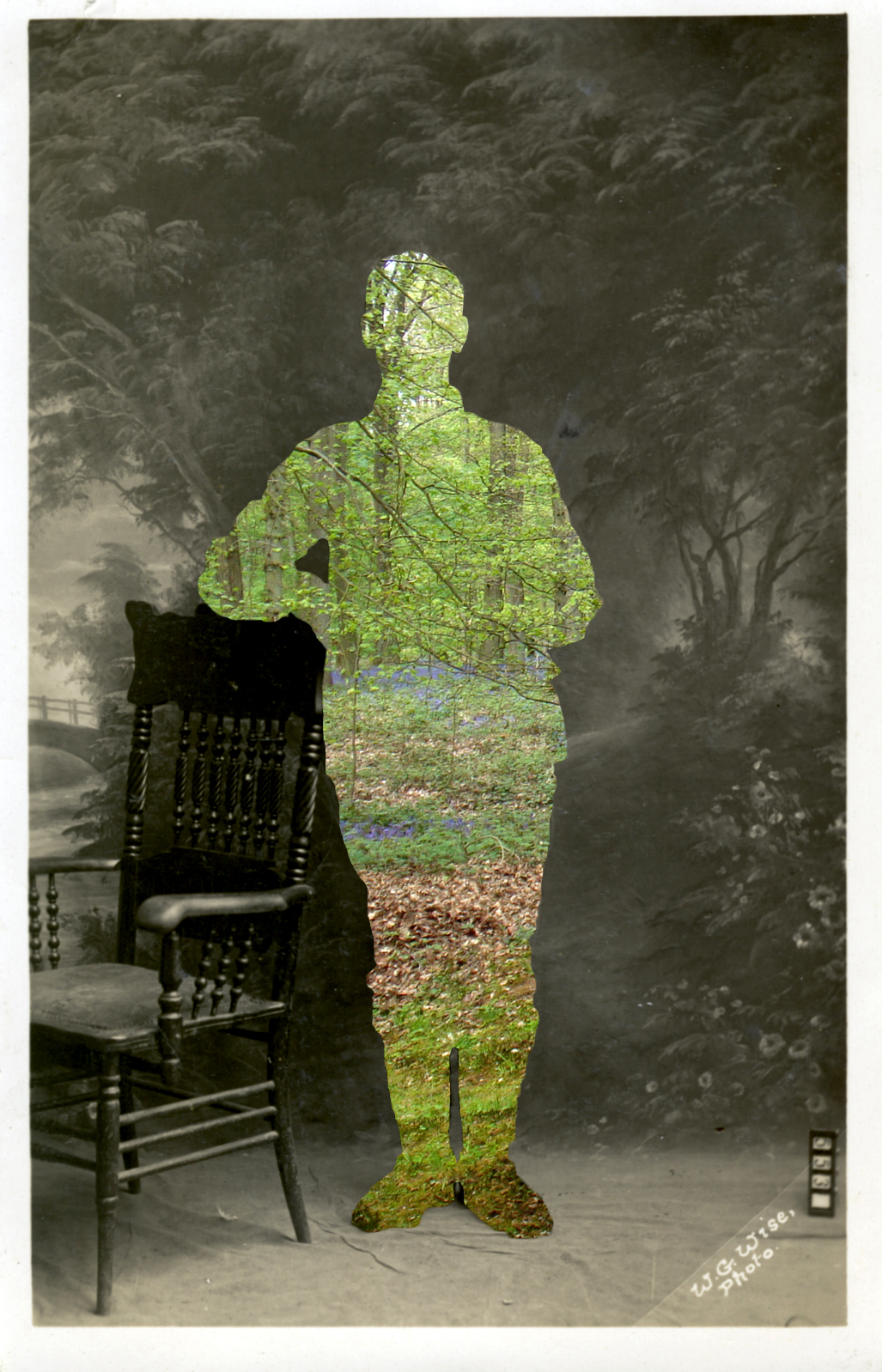
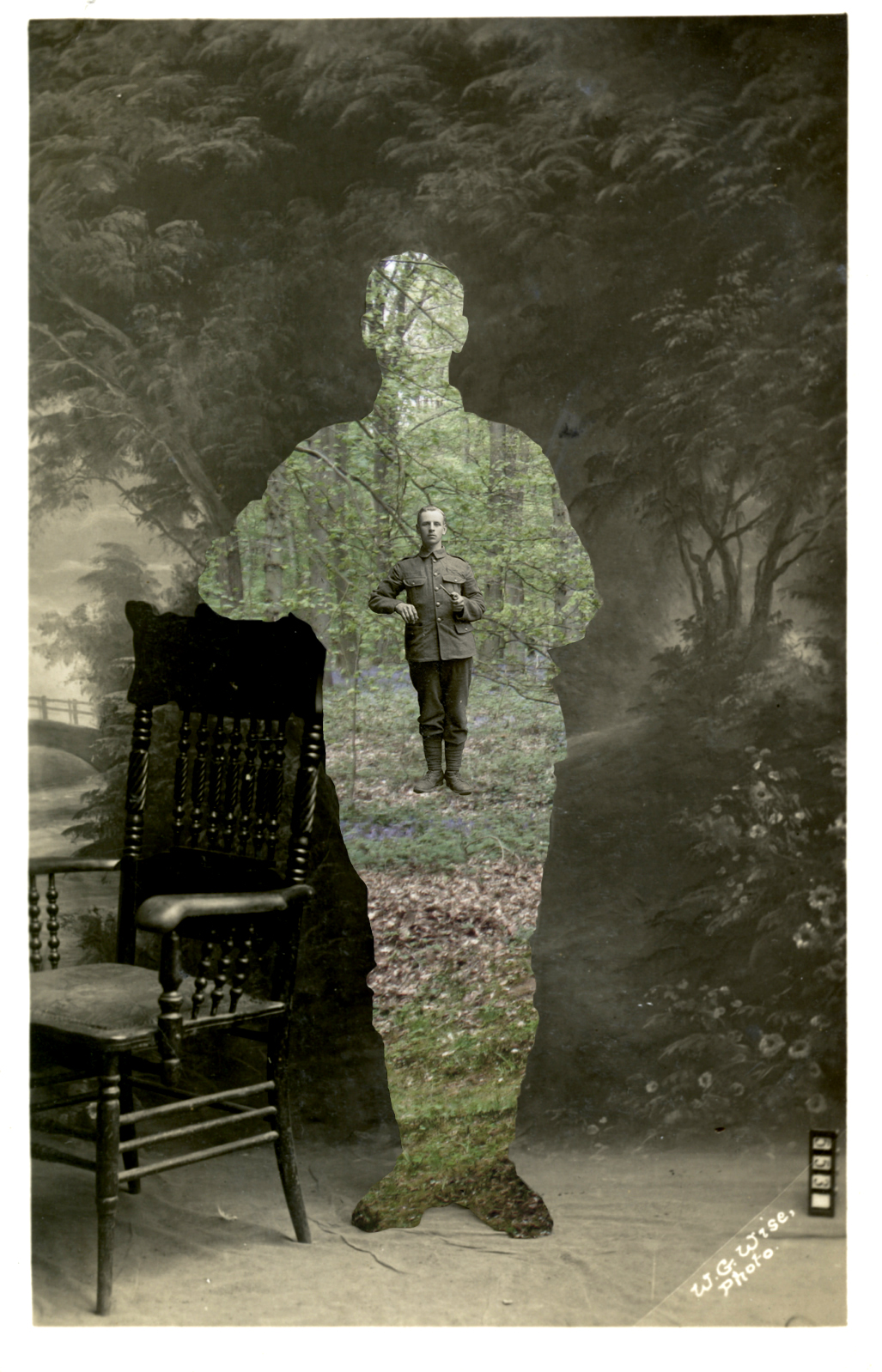
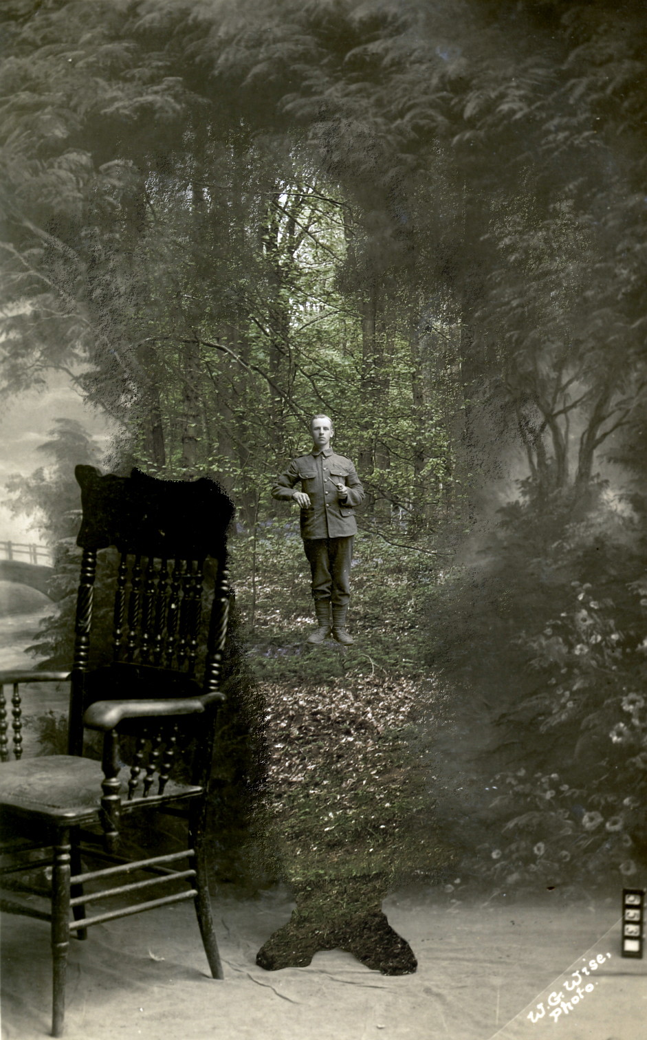
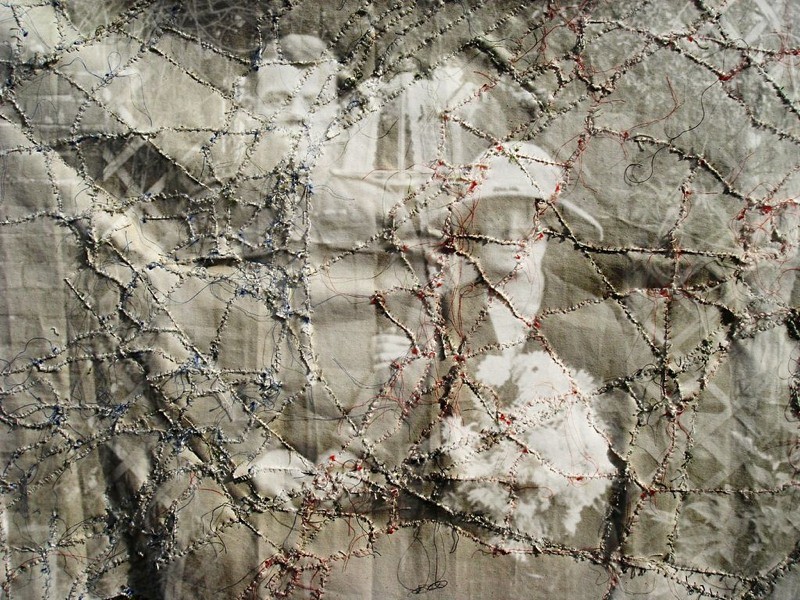
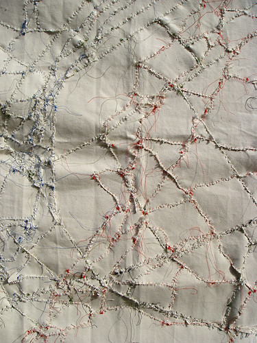
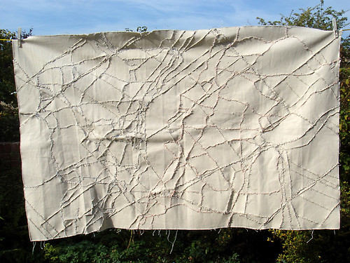
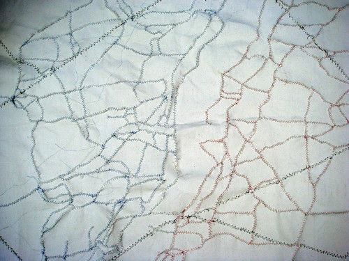
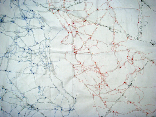
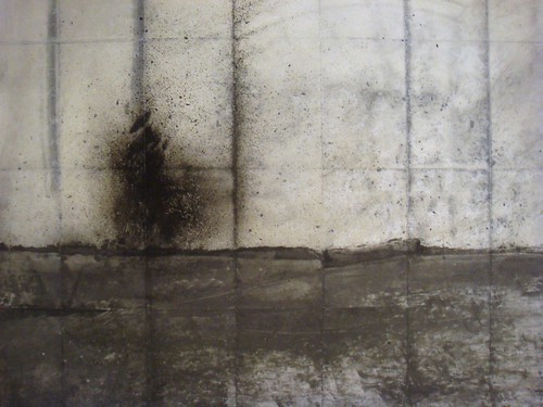
One of the nicest compliments I received during Friday’s private view was ‘…these remind me of Siegfried Sassoon…’. The works in question were those images of imagined World War I landscapes painted onto folded paper, one of which I have shown below:

DSC07879

In fact, the war poets were brought up a number of times in relation to these works which – for obvious reasons – pleased me enormously. But, I wondered what it was about these pieces which called to mind the poets?

One of the poets I’ve become increasingly interested in, is Edward Thomas – killed at the battle of Arras in 1917. I first became aware of his work whilst reading a book of World War I poetry, in which I found his poem ‘Roads’ (a poem I’ve already discussed in relation to my work). It was then in Robert Macfarlane’s book ‘Wild Places’ that I encountered Thomas again, this time in relation to another poet, Ivor Gurney. In a previous blog I wrote:

After returning from the war, Ivor Gurney, like so many others suffered a breakdown (he’d suffered his first in 1913) and a passage in Macfarlane’s book, which describes the visits to Gurney – within the Dartford asylum – by Helen Thomas, the widow of Edward Thomas is particularly moving. Helen took with her one of her husband’s Ordnance survey maps of Gloucestershire:

‘She recalled afterwards that Gurney, on being shown the map, took it at once from her, and spread it out on his bed, in his hot little white-tiled room in the asylum, with the sunlight falling in patterns upon the floor. Then the two of them kneeled together by the bed and traced out, with their fingers, walks that they and Edward had taken in the past.’

Macfarlane discusses Thomas in another book, ‘The Old Ways: A Journey on Foot,’ in which he writes how for Thomas, paths “connected real places but… also led outwards to metaphysics, backwards to history and inwards to the self. These traverses – between the conceptual, the spectral and the personal – occur often without signage in his writing, and are among its most characteristic events. He imagined himself in topographical terms. Corners, junctions, stiles, fingerposts, forks, crossroads, trivia, beckoning over-the-hill paths, tracks that led to danger, death or bliss: he internalized the features of path-filled landscapes such that they gave form to his melancholy and his hopes. Walking was a means of personal myth-making, but it also shaped his everyday longings: he not only thought on paths and of them, but also with them.”

DSC07578

Ever since I walked a path in Wales on which I knew my great-great grandfather walked every day to the mine in which he worked, I’ve been interested in the idea of people as place (and vice-versa) – see Landscape DNA – the simultaneity of stories so far. The path from the small town of Hafodyrynys to Llanhilleth where he worked, not only connected those two places, it also connected me with my ancestor. It did just what Thomas suggested; connected real places but also went backwards to the past and inwards to my own self. As Macfarlane puts it: “paths run through people as surely as they run through places.”

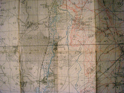
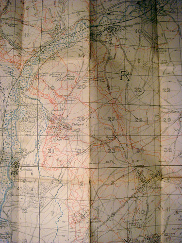
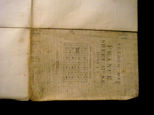
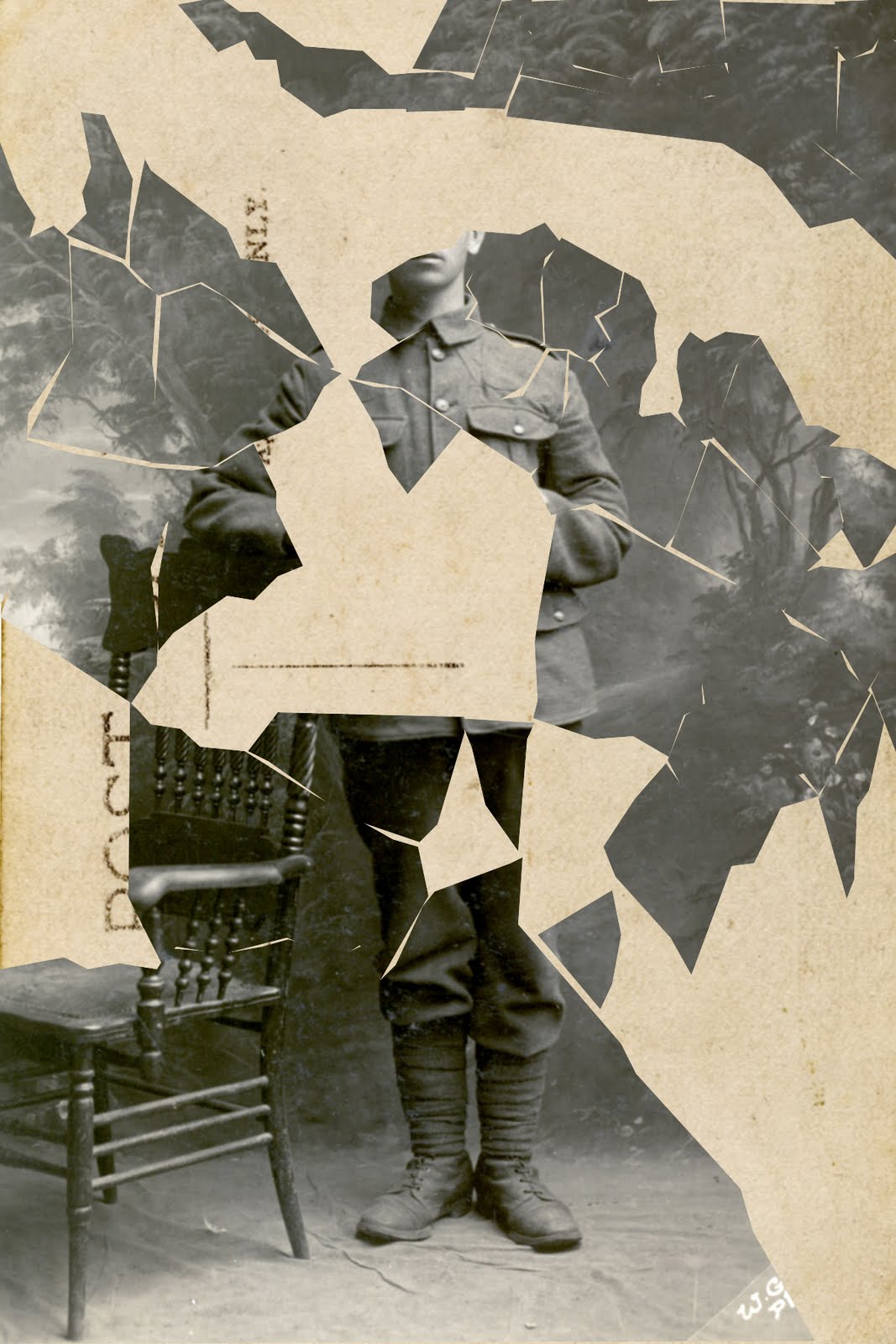
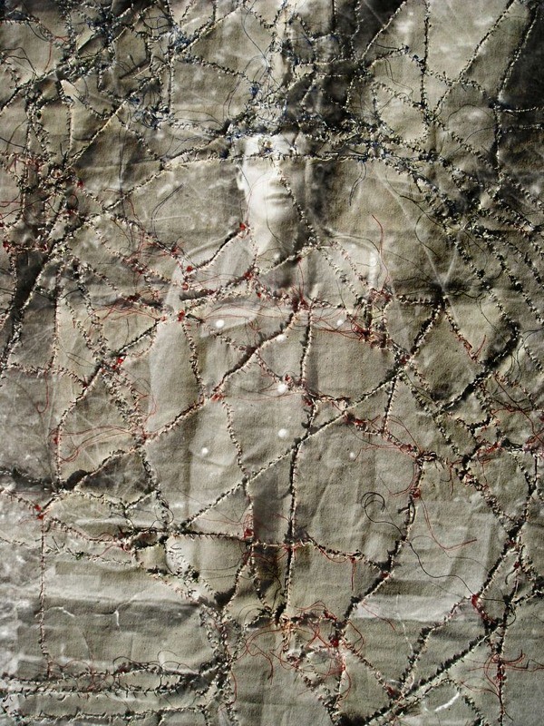
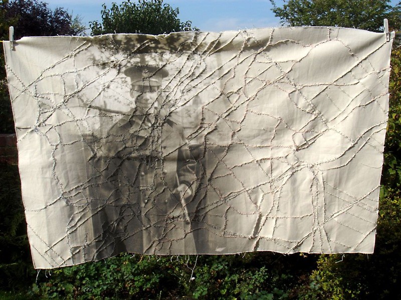
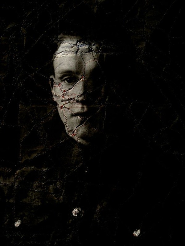
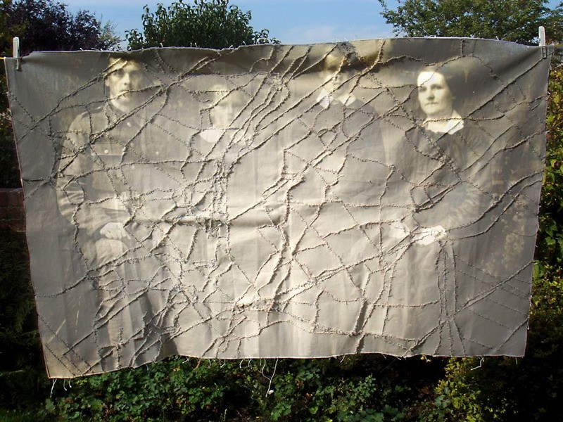
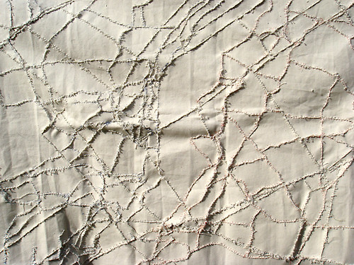
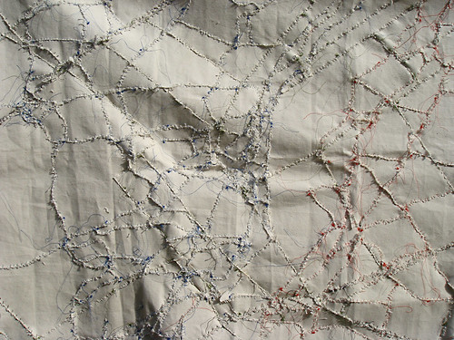
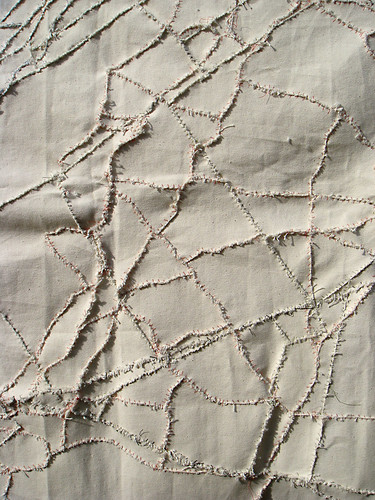
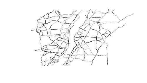
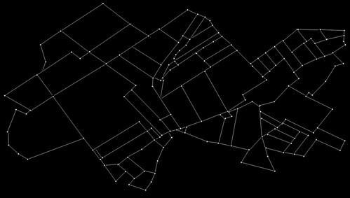
It was important for me that the images shown above did not appear so much as pictures – objects stuck on a wall – as objects of use. I wanted them to appear as if they’d been unfolded rather than simply painted, that like maps, they could be read rather than simply looked at. I wanted them to retain the potential for being folded (which, if they were framed, wouldn’t have been possible) for this inherent potential of folding and unfolding refers back to an observation I made whilst studying an old trench map.

DSC07754

During that observation I wrote, “…the past movements associated with this map are therefore recorded in its folds. It resists being folded any other way.”

The folds in the map are like ancient paths in a landscape. We can walk (within reason) wherever we like through a place, but more often than not, we will follow the way of countless others before us. Paths are themselves like folds within the landscape, and we, like the map, resist being folded any other way.

Trench Map 1916

Macfarlane again writes how for Thomas “…map-reading approached mysticism: he described it as an ‘old power’, of which only a few people had the ‘glimmerings’.”

These glimmerings reminded me of a passage I read in Merlin Coverley’s book Psychogeography, in which he writes: “Certain shifting angles, certain receding perspectives, allow us to glimpse original conceptions of space, but this vision remains fragmentary…”

These ‘glimmerings’or ‘shifting angles’ are best seen or accessed through the everyday; observations of which I record in other map works.

Map Work

This is something which Macfarlane again seems to allude to in ‘The Old Ways: A Journey on Foot’, when he writes: “The journeys told here take their bearings from the distant past, but also from the debris and phenomena of the present, for this is often a double insistence of old landscapes: that they be read in the then but felt in the now. The waymarkers of my walks were not only dolmens, tumuli and long barrows, but also last year’s ash-leaf frails (brittle in the hand), last night’s fox scat (rank in the nose), this minute’s bird call (sharp in the ear), the pylon’s lyric crackle and the crop-sprayer’s hiss.”

As I have recorded in my text-maps:

A man talks holding his hat
A flag flies, fluttering in the growing wind
The next bus is due
A car beeps
Amber, red, the signal beeps
The brakes hiss on a bus

Maps are objects which we fold and unfold. We unfold them to find our place within the landscape. We fold them and carry them with us. The process or unfolding and (en)folding: the idea that the past can be seen as being enfolded within the smallest objects and everyday observations in vital to my work; as is the way in which we are enfolded (written) into the landscape as we walk; the way in which the landscape is unfolded as we travel across it. Knowledge, likewise, is also unfolded in this way. As Tim Ingold writes in ‘Being Alive: Essays on Movement, Knowledge and Description’:

“…knowledge is perpetually ‘under construction… the things of this world are their stories, identified not by fixed attributes but by their paths of movement in an unfolding [my italics] field of relations. Each is the focus of ongoing activity. Thus in the storied world… things do not exist, they occur. Where things meet, occurrences intertwine, as each becomes bound up in the other’s story. Every such binding is a place or topic. It is in this binding that knowledge is generated.”

Empathy is another important aspect of my work and I’ve stated before that empathy is an augmented discourse between bodily experience and knowledge. I like to think that with these works I’ve discovered a means of expressing that.

Finally, the works I’ve made are fragile pieces, and in another passage on Thomas, I found in Macfarlane’s prose a sentence which describes why they should be so: “His poems are thronged with ghosts, dark doubles, and deep forests in which paths peter out; his landscapes are often brittle surfaces, prone to sudden collapse.”

Perhaps this, in part, answers my question above.

Filed Under: Lists, Poetry Tagged With: Broken Landscape, Edward Thomas, Ivor Gurney, Listmaking, Lists, Maps, Paths, Poetry, Trench Maps, Walks, War Poets, World War I, WWI

Kaleidoscope – Exhibition

October 14, 2012 by Nicholas Hedges

Some photos from Kaleidoscope; the exhibition I, along with my fiancee Addy Gardner, are currently staging at The North Wall Gallery, South Parade, Summertown, Oxford. The exhibition runs until 3rd November. See website for more details.

Filed Under: Artist in Residence Tagged With: Addy Gardner, Artist in Residence, Australia, Kaleidoscope, World War I, WWI

Aerial Views

August 19, 2012 by Nicholas Hedges

I worked on a piece yesterday, the origins of which were a GPS trace of trench systems around the village of Serre. I had the idea of ‘colouring’ each segment using ash, graphite and coal dust, but of course the boundaries between these segments blurred into more or less one. However, I liked the look of what I’d produced, which reminded me – in particular where I’d made the lines visible using a palette knife – of aerial photographs I’d seen of the trenches.

The first image I produced:

DSC07650

An aerial view of battlefields taken during the First World War:

The coal dust is significant for me as it alludes to the miners who worked beneath the battlefields, as well as those miners who were called up for duty such as my own great-great-uncle, Jonah Rogers who was killed near Ypres in 1915.
What I’d like to do now, is do another piece, creating the same texture but only using the folds of the paper to create the lines (and perhaps the creases).

Filed Under: World War I Tagged With: Aerial Views, Family History, Jonah Rogers, World War I, WWI

Painted Trees

July 16, 2012 by Nicholas Hedges

Taken from World War I studio portraits.

WW1 Backdrops

WW1 Backdrops

WW1 Backdrops

WW1 Backdrops

WW1 Backdrops

WW1 Backdrops

WW1 Backdrops

WW1 Backdrops

WW1 Backdrops

WW1 Backdrops

WW1 Backdrops

WW1 Backdrops

WW1 Backdrops

WW1 Backdrops

WW1 Backdrops

WW1 Backdrops

Filed Under: Trees, World War I Tagged With: Backdrops, The Trees, Trees, World War I, WWI, WWI Postcards

Maps and Ivory Gurney

July 16, 2012 by Nicholas Hedges

On the bus into work this morning I read the following in Robert Macfarlane’s ‘The Wild Places.’

“Woods and forests have been essential to the imagination of these islands, and of countries throughout the world, for centuries. It is for this reason that when woods are felled, when they are suppressed by tarmac and concrete and asphalt, it is not only unique species and habitats that disappear, but also unique memories, unique forms of thought. Woods, like other wild places, can kindle new ways of being or cognition in people, can urge their minds differently.”

Woods have always been places of intense interest to me, particularly as a boy when I would love to imagine England as being covered in ancient woodland. My interest in history wasnt so much an interest in the characters and machinations of past times, but a means of accessing the landscape of those times – a way into the woods. 

I would create maps of imagined places, all of which would be home to vast swathes of untouched and unspoiled forests. And while those maps were ‘of places’, they were much more a means into a place, a path into and through my imagination.

In the same book ‘The Wild Places,’ Macfarlane briefly discusses the poet, composer and songwriter Ivor Gurney (1890-1937) who like the poet Edward Thomas, loved to explore the countryside of his native county – Gloucestershire. In 1915, Gurney enlisted to fight in the Great War, and in the battlefields of the Ypres Salient, discovered what Macfarlane describes as an ‘anti-landscape,’ a place in which the only evidence of forests ‘were upright bare dead trunks, stripped of leaves, branches and bark by shrapnel and gunfire.’ As Macfarlane writes: ‘On the military maps of the area that Gurney used, some of the old names of the landscape remained. But many of the new names spoke of the avoidance of death, or of its arrival. Shrapnel Corner, Crump Farm, Hellfire Corner, Halfway House, Dead Dog Farm, Battle Wood, Sanctuary Wood. The woods were no longer there, however; these were ghost names only. The trees had been felled for revetting, or blasted from the earth by shells.’

As someone with an interest in maps and in trench maps, the above passage interested me, particularly as I’ve often thought about how the landscape of the First World war, replete with all its new names and new features, had been superimposed, or rather gouged out of the landsape, only to smoothed over with the passage of time. Its was a sudden landscape. A few scars, smoothed over with grass – or hidden by trees – are all that’s left, but the wounds are still weeping in its names – not so much those of soldiers inscribed on the thousands of headstones, but rather the names of places – Arras, The Somme, Ypres and Passchendaele. 

Trench Map 1916
Trench Map (1915)

In many places the woods have returned, and while the landscape today bears little resemblance to that of the war  – in which ‘the rich and complicated pasts of the trees that Gurney cherished’ had been so utterly effaced, it is nonetheless within those woods that one’s imagination picks up the voices of the past – of the fallen; voices which spoke in the midst of battle, of places and people cherished back home.

The Somme
Woods in The Somme

After returning from the war, Ivor Gurney, like so many others suffered a breakdown (he’d suffered his first in 1913) and a passage in Macfarlane’s book, which describes the visits to Gurney – within the Dartford asylum – by Helen Thomas, the widow of Edward Thomas is particularly moving. Helen took with her one of her husband’s Ordnance survey maps of Gloucestershire:

‘She recalled afterwards that Gurney, on being shown the map, took it at once from her, and spread it out on his bed, in his hot little white-tiled room in the asylum, with the sunlight falling in patterns upon the floor. Then the two of them kneeled together by the bed and traced out, with their fingers, walks that they and Edward had taken in the past.’

The map they laid on the bed was one that showed the familiar trails and paths of the countryside. But it was also one which, like that I made in my childhood, gave Gurney access to his imagination – to his own past. Together, the patient and his visitor read it with their fingers, following the trails as one follows words on a page. A narrative of sorts was revealed, memories stitched together by the threads of roads, paths and trails.

Filed Under: Trees, World War I Tagged With: Edward Thomas, Ivor Gurney, Maps, The Somme, Trench Maps, War Poets, World War I, WWI

Completed Map

July 10, 2012 by Nicholas Hedges

Today, on a walk around Oxford, I completed my first text map which I began in Ampney Crucis about a month ago. Below is both the map and an image of the walks as recorded on my GPS (and then ‘arranged’ in Photoshop).

Map Work
Map Work

Filed Under: Lists, World War I Tagged With: GPS, Lines, Listmaking, Lists, Map, Positioning, Text Work, Walks, World War I, WWI

New Work 3

February 20, 2012 by Nicholas Hedges

Filed Under: World War I Tagged With: Soldiers, The Somme, The Trees, Trees, World War I, WWI, WWI Postcards, WWI Postcards

New Work 2

February 9, 2012 by Nicholas Hedges

Filed Under: World War I Tagged With: Soldiers, The Somme, The Trees, Trees, World War I, WWI, WWI Postcards, WWI Postcards

New Work

February 7, 2012 by Nicholas Hedges

Filed Under: World War I Tagged With: Soldiers, The Somme, The Trees, Trees, World War I, WWI, WWI Postcards, WWI Postcards

Goethean Observation: World War I Trench Map

February 2, 2012 by Nicholas Hedges

Less a Goethean observation and a more general observation with reference to the Goethean method (click here to read more about Goethean Observation).

Note: The aim of this observation is not to write a beautiful prose account of the map, but rather to look, observe and find a hook upon which to hang the next piece of research into this subject.

Trench Map 1916

The map has been printed on a large sheet of paper creased vertically and horizontally with lines where the map has been folded and opened. The paper itself is a brownish-white, darker along the lines of the folds and around the edges in places. The corners on the left hand side are a little dog-eared.

The map on one side shows the area concerned – a part of France as the map tells me at the top. This side of the paper is smooth to the touch, but on the reverse I can feel a tooth. Folding over the first fold, I can see the tooth on the ‘reverse’ very clearly. The [fabric of the] paper is made up of very straight vertical lines, with wonkier lines running horizontally. There are four ‘squares’ (actually rectangles) to each folded column and eight folded columns (7 creases) in all. There are four folded rows (3 creases).

The ‘square’ at the top of the first vertical fold on the reverse side of the map tells me this is a ‘Trench Map’. Like the bottom square, the colour of the paper is much darker than the rest. The two squares in between are like the colour of the map on the reverse side – possibly even lighter. This shows how the map, when folded, has a front and a reverse side. Having turned over the map so that this first fold appears on the right I can see all 32 ‘squares’ that make up the map. The folds are particularly prominent, some darker than others. Some of the squares show no sign – or at least – very little sign of wear. There are some splits in some of the folds – caused of course by the repeated action of opening and closing the map.

Trench Map 1916

Six ‘squares’ along the top two are covered with words – French words and their English translations. The words are the names of landscape features such as tree (arbre), gate/stile (barrière), oak tree (chêne) and pond (etang). The rest of the squares, including one on this top row are blank. All one can see is the pattern of the paper’s fabric.

Turning the map over, one is aware of the holes and the sound the paper makes. It reminds me of a soft version of the crackle of a fire.

The drawing of the landscape takes up much of this side of the paper with explanatory texts and a key beneath as well as to the right of the map.

Looking at the details of the map, one can see the various features of the landscape – the woods, roads, hills (through contour lines), rivers, ponds or lakes and of course various towns and villages. All these features, along with the names and the grid are printed in a ‘black’ ink which actually appears as a light ‘browny’ grey.

Trench Map 1916

What one’s eye is drawn to straight away however are the patches of colour on the right hand side of the map; blue and red. The colours have been used to colour a multitude of lines which run from the top of the page to the bottom. The majority of these are red. There is one dashed blue line which snakes from top to bottom to the left of the furthest-most red line and to the left of that, the same colour has been used to mark out the landscape features showing rivers, lakes and what appears to be marshy land.

The red lines themselves have been drawn in a sort of ‘stepped’ way and cover a quarter of the map up to the right hand side. Looking closely at these lines, one is made aware of the other lines of the map – black curved lines, straight vertical and horizontal lines; straight vertical and horizontal dotted lines – these lines divide each square (delineated by the other straight lines) into four quarters.

In each of the large squares there are numbers, the greatest of which appears to be 36. Among some of these numbers, there are also letters – P, Q, R, V, W, X.

As I look at the map I begin to notice the mix of French and English words/names. The place names are clearly French; La Boiselle, Thiepval, Authuille, Contelmaison, Beaumont-Hamel. In amongst these however are names like Tara Hill, The Crucifix, Railway Copse, Brickworks, Pond Bridge and Cemetery. There also appear to be instructions: ‘35 to 40 ft deep: Impractical for Cavalry.’ There is also a largish hole above Pozières.

Folding the paper up, it fits entirely in my hand. It is like a concertina, about an inch thick without too much pressure applied.

Trench Map 1916

Looking more closely at the front of the folded map, I can see the words:

Trench Map
France
Sheet 57D S.E.
Edition 2.D.

There is then a diagram – an ‘index to adjoining sheets’ beneath which are the words and numerals:

Scale: 1/20,000

On the left hand side of this ‘face’ are what appear to be two initials, DM. The map smells of its age, a musty smell of something that for a long time was forgotten.

On the diagram I can see a small square which has been shaded in to distinguish it from all the others. One can see that this piece of paper is part of a much larger map measuring ‘eight maps’ wide and ‘eight maps’ high.

The map is clearly old. The date 1916 has been printed on the ‘map’ side, but even without this, the style of the printing and the condition tells me it’s of some age. Through its age it has expanded in its folded form. The folds aren’t as crisp as they were. It has no doubt lain forgotten in an attic or some such place, acquiring its patina and its smell. As the dust has grown, the text has faded, although the edges of each letter are crisp. And still I can see the ‘DM’ in pencil on the left hand side.

It doesn’t resist being folded again. First vertically and then horizontally.

I unfold it and instinctively flatten it down. The folds in places rise up. The fold which runs vertically through the red lines does especially. This part of the map won’t remain flat unless I press it down with my hand. As I do, my head instinctively lifts a little and my eyes move along the lines of red to rest around the village of Thiepval.

These actions would no doubt have been repeated in the past when the map was perhaps more pristine – when the folds were sharper and the map lay flat.

The map, when I lift it up, seems to want to fold into a particular shape. It doesn’t want to be put away, but rather be folded so that two columns remain in view. The folds which delineate this part are a darker brown than all the others. In this section of the map is a concentration of red lines and blue lines.

The way it folds suggests that this was what was most important. When I pick up the map to fold it completely, it folds so that the ‘front’ and ‘reverse’ are tucked away. The front now is one of the segments or ‘squares’ containing French words (Sondage) and their English equivalents (Boring – as in cut).
The past movements associated with this map are therefore recorded in its folds. It resists being folded any other way.

We know the map was made in 1916 with minor corrections to details on 15.8.16. This is just six weeks after the first offensive in the Battle of the Somme. Shortly after this period the map would have been replaced with another as the landscape changed with each offensive.

When I look at this map from the comfort of my own front room I see history – albeit one written in a less conventional way. It still has words and pictures.

For much of its life it was no doubt a curiosity. Maybe it was a reminder for those that were there who when looking at the lines would have seen something very different – not on the map but in their minds.

Those who used the map would have seen something else. By August 1916, the colossal tragedy of the first day of the Somme would have been etched on everyone’s mind. The contour lines can hardly tell the reality of the ground’s undulations, and yet it was these which meant the difference between life and death. The map serves to distance us from reality.

Considering its past, the action of being folded and then unfolded over and over, one can almost imagine a bellows lifting and then depressing, letting out air like a breath – a last gasp.

The map is like a palimpsest, albeit one which is just a single print. One can see the original landscape which over the years changed as landscape features assumed English monikers. It is a place that appears at once to be real and imagined – a non sort of place.

‘The Poodles’, ‘The Dingle’, ‘Willow Patch’, ‘Round Wood’, ‘Birch Tree Wood’, – they all have the sound of something made up – a children’s story. ‘Middle Wood’, ‘Villa Wood’, ‘Lonely Copse’. There is even marked ‘a row of apple trees’. These names – these alien names – all appear on the right hand side of the map; on the left, large swathes of woodland go unnamed.

The same is true of road names.

Observation of certain parts of the map has changed the way it moves – these movements seem impressed into the map’s fabric.

When I stand to look at the map, I stand as, no doubt, others stood around it. I can again imagine the creases as sharper, the colour of the paper whiter, the lines more vivid.

Looking at the map, unfolding it and folding it, smoothing down the paper, one gets the sense of an individual. 1/20,000. The map as an object tells me about the individual who looked at it. What is pictured tells me – when I think of the scale – about the thousands of men killed on that first day of the Somme.

One gets the sense of other maps printed before this one, upon which this one is based – each one covering over the horror of the most recent losses of life. They become like shrouds.

Each one would have been used to plan the next map, and the next, and so on, until there weren’t any red lines left.

Filed Under: Goethean Observations, Trees Tagged With: Goethean Observation, Trench Maps, World War I, WWI

Past and Present Postcard

January 25, 2012 by Nicholas Hedges

The image below is the last in a series I’ve made using both an original World War One postcard and a photograph I took in Verdun. All are works in progress.

I’ve been fascinated with the backdrops in some of these postcards for quite some time now and have been looking at ways of using them in works relating to the Great War and, in particular, the issue of empathy.

The original postcard is of course in black and white (with a greenish tint) and shows a soldier about to head to the Front, standing, leaning on a chair.

Behind him is an idealised image – an idyllic, invented landscape, a far cry from what he was, perhaps, about to encounter, but close in some respects to what we find on battlefields today; where there were trenches, arms, barbed wire and bodies, there are now trees. And amidst the trees, incongruous concrete Pill Boxes stand and watch as the seasons come and go. Everything is slowly reclaimed. The trees in the image at the top of the blog spill to reclaim the past – the interior of the studio – through the gap left by the missing soldier.

I have placed the solider back beyond the gap left by the vague shape of his own body, to remind us that people like the soldiers we see in all these postcards, were once like those of us who have visited the battlefields. They too would have known what it was to stand in a wood. To listen to the wind blowing through the branches.

To stand and do just that, is one way to remember them.

Filed Under: Trees, World War I Tagged With: Soldiers, The Somme, The Trees, Trees, World War I, WWI, WWI Postcards

Work in Progress

January 24, 2012 by Nicholas Hedges

Filed Under: World War I Tagged With: Soldiers, The Somme, The Trees, Trees, World War I, WWI, WWI Postcards, WWI Postcards

New Work (WW1) 2

November 16, 2011 by Nicholas Hedges

Looking again at the latest work I’ve done (see previous entry), I decided to make the image of the man less clear. Taking away his face, I found my attention drawn to his hand which in turn reminded me of some work I’d done on hands with regards photographs from World War I.

Filed Under: Photography Tagged With: Fragments, Soldiers, Vintage Photographs, World War I, WWI, WWI Postcards

New Work (WW1)

November 15, 2011 by Nicholas Hedges

Again using the idea of the lines/patterns of trenches, I’ve reworked an earlier idea using an old World War One postcard.

Filed Under: Photography Tagged With: Fragments, Soldiers, Vintage Photographs, World War I, WWI, WWI Postcards

New Work in Progress (WW1)

October 7, 2011 by Nicholas Hedges


Filed Under: World War I Tagged With: Serre Palimpsest, Stitchwork, Trench Maps, World War I, WWI, WWI Postcards, WWI Postcards

Projections

October 7, 2011 by Nicholas Hedges

Having completed my last stitching project based on trench maps from World War I, I decided to try and superimpose some postcard portraits onto them, of soldiers headed for the Front. In the first (below) I used the photograph of a family which I ‘projected’ onto the map as shown hanging on a washing line.


What strikes me about this image as a whole, is the contrast between now and then as it exists in the contrast between the black and white of the photograph and the colour of the day. This colour, and the sense of the nowness of the present, helps strengthen my own empathetic feelings towards those long since lost – and all but forgotten – to history.

The fact the map hangs on a line like an item of washing, also reinforces the sense of domesticity which is a theme running through some of the postcard portraits, many of which were taken in the backyards of soldiers (or their parents), where evidence of the everydayness of domestic life is in abundance.

One such photograph shows a young couple who’ve recently been married. They stand, unsure of what the future brings, both wearing a look full of apprehension, staring into the lens of the camera, as if this ‘clock for seeing’ as Barthes once referred to them, really could show them the future.

The image onto which their portrait has been projected shows the reverse side of the map, where the threads used to stitch the past together hang like the cut threads of countless lives.

Filed Under: World War I Tagged With: Empathy, Serre Palimpsest, Stitchwork, Trench Maps, World War I, WWI, WWI Postcards, WWI Postcards

Serre Palimpsest (completed)

October 1, 2011 by Nicholas Hedges

I’ve just completed – after several weeks of stitching – a piece of work called ‘Serre Palimpsest’ the creation of which I’ve been documenting on my blog. It became apparent soon after I started this work that this was a piece with two sides which may seem an obvious thing to say, but it seemed to me that the two sides we’re saying different things, just as things below the surface say something different to those above, whilst as the same time remaining connected.

The two images below show the completed work. The first, the front:

Serre Palimpsest

The second, the reverse:

Serre Palimpsest

The lines stitched in black show the roads before the war (the modern day road system is pretty much the same), the blue stitching and red show the British and German trenches respectively – with No Man’s Land between, and the green stitching shows the modern day field boundaries.

What was interesting about creating the work was how the threads from the reverse of the piece would emerge into the front, mirroring the way pieces of the past (bits of old shell etc.) find their way to the surface after many years below the ground. The cut lines on the reverse made me think of the paths soldiers would have taken to get there; paths which in many cases were cut in the Somme.

Serre Palimpsest

Serre Palimpsest

Occasionally, the threads would be tied together on the reverse which again made me think of how our lives today are similar to those who died in that their lives were lived lives too; of course their circumstances couldn’t have been more different, but the fact is that the vast statistics of the Somme comprise real individuals.

To take the photographs I hung the piece on the washing line. The weather was unseasonably hot and sunny, much like the weather would have been on the first day of the Battle of the Somme (1st July 1916). As I looked as the work swaying gently in the breeze, I thought about the photographs taken in the back gardens of those who were about to set off for the Front. I was reminded too of the backdrops used in studio-based photographs.

Serre Palimpsest

World War 1 Serviceman

World War 1 Serviceman

Filed Under: World War I Tagged With: Lines, Serre Palimpsest, Stitchwork, Trench Maps, World War I, WWI, WWI Postcards, WWI Postcards

Serre Palimpsest II

August 9, 2011 by Nicholas Hedges

I’ve just finished the second phase of a piece of work called Serre Palimpsest the results of which can be seen below.

Serre Palimpsest

Reverse side

Serre Palimpsest

So far I’ve stitched in the roads around Serre and the British and German trenches from the First World War. Next I’ll cut the fabric again to stitch in the modern day field boundaries.

Filed Under: World War I Tagged With: Lines, Serre Palimpsest, Stitchwork, Trench Maps, World War I, WWI

Serre Palimpsest

June 19, 2011 by Nicholas Hedges

Serre Palimpsest

Filed Under: World War I Tagged With: GPS, Positioning, Serre Palimpsest, Stitchwork, Trench Maps, World War I, WWI

Stitched Trench Map – Patterns

June 19, 2011 by Nicholas Hedges

Three patterns will be used for this piece of work: 1) a map of the pre-war road system around Serre, France; 2) a map of the First World War trench system around the same area, and 3) a map of the area’s modern day field boundaries.

A single piece of fabric will be cut, firstly according to the pattern of roads.

3maps-roads

This same piece will then be re-cut according to the pattern of trenches.

3maps-trenches

And finally, this will be cut a third time according to modern day field boundaries.

3maps-fields

The final stitched piece of fabric might then look something like this:

3maps-roads-trenches-fields

Looking at the images reminded me of star constellations, and so I inverted two of the images to see how they looked.

3maps-roads-inv

3maps-fields-inv

See Serre Palimpsest.

Filed Under: World War I Tagged With: Serre Palimpsest, Stitchwork, Trench Maps, World War I, WWI

  • « Previous Page
  • 1
  • 2
  • 3
  • 4
  • Next Page »

© Nicholas Hedges 2024

  • Facebook
  • Instagram
  • Twitter
  • YouTube

Copyright © 2025 · Outreach Pro on Genesis Framework · WordPress · Log in